Khemis El Khechna District: Difference between revisions
Appearance
Content deleted Content added
m Dating maintenance tags: {{Unreferenced}} |
No edit summary |
||
| Line 1: | Line 1: | ||
{{unreferenced|date=July 2012}} |
|||
{{Infobox district |
{{Infobox district |
||
<!-- See Template:Infobox settlement for additional fields and descriptions --> |
<!-- See Template:Infobox settlement for additional fields and descriptions --> |
||
Revision as of 02:20, 20 October 2012
Khemis El Khechna District
دائرة خميس الخشنة | |
|---|---|
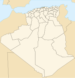
 Map of Algeria highlighting Boumerdès Province | |
| Country | |
| Province | Boumerdès |
| District seat | Khemis El Khechna |
| Population (1998) | |
• Total | 128,444 |
| Time zone | UTC+01 (CET) |
| Municipalities | 4 |
Khemis El Khechna is a district in Boumerdès Province, Algeria. It is the most populous district in the province. It was named after its capital, Khemis El Khechna, which is also the most populous municipality in the province. It is 30km away from the Boumerdese capital. Prior to 1974 it was known as Fondouk.
It was founded in 1845 by order of L. Philip. Its first mayor was named Raboil.
It is considered one of Algeria's richest regions, with a strong fishing industry.
Municipalities
The district is further divided into 4 municipalities:
