Bitgum: Difference between revisions
Appearance
Content deleted Content added
mNo edit summary |
m Bot: Migrating 3 interwiki links, now provided by Wikidata on d:q2340734 |
||
| Line 20: | Line 20: | ||
{{Friesland-geo-stub}} |
{{Friesland-geo-stub}} |
||
{{coord|53|14|12|N|5|41|15|E|display=title|region:NL_type:city_source:nlwiki}} |
{{coord|53|14|12|N|5|41|15|E|display=title|region:NL_type:city_source:nlwiki}} |
||
[[fr:Bitgum]] |
|||
[[fy:Bitgum]] |
|||
[[nl:Beetgum]] |
|||
Revision as of 16:35, 8 March 2013
Beetgum | |
|---|---|
Village | |
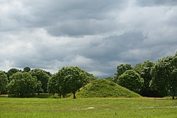
 Beetgum's "Hege Wier", remains of one of 5 "stiens", or medieval castles in Friesland | |
 | |
| Country | |
| Province | |
| Municipality | Menameradiel |
| Population | |
• Total | c. 735 |
Beetgum (Template:Lang-fry) is a small village in Menameradiel in the province Friesland of the Netherlands and has around the 735 citizens (2005).

