Dolní Stakory: Difference between revisions
Appearance
Content deleted Content added
m Bot: Migrating 7 interwiki links, now provided by Wikidata on d:q763147 (Report Errors) |
|||
| Line 92: | Line 92: | ||
{{MladáBoleslav-geo-stub}} |
{{MladáBoleslav-geo-stub}} |
||
[[ms:Dolní Stakory]] |
|||
Revision as of 12:36, 20 March 2013
You can help expand this article with text translated from the corresponding article in Czech. (July 2009) Click [show] for important translation instructions.
|
Dolní Stakory | |
|---|---|
Municipality and village | |
 | |
 | |
| Country | |
| Region | Central Bohemian Region |
| District | Mladá Boleslav District |
| Area | |
• Total | 1.49 sq mi (3.86 km2) |
| Elevation | 768 ft (234 m) |
| Population (2011) | |
• Total | 256 |
| • Density | 170/sq mi (66/km2) |
| Time zone | UTC+1 (CET) |
| • Summer (DST) | UTC+2 (CEST) |
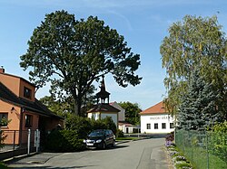
Dolní Stakory is a village and municipality in Mladá Boleslav District in the Central Bohemian Region of the Czech Republic.
References
- This article was initially translated from the Czech Wikipedia.


