Glass House Mountains National Park: Difference between revisions
Cottonland (talk | contribs) |
Cottonland (talk | contribs) |
||
| Line 56: | Line 56: | ||
* [[Wild Horse Mountain]], 123 m |
* [[Wild Horse Mountain]], 123 m |
||
Mount Beerwah is the highest peak within the park at {{convert|555|m|abbr=on}} however public access to the 'tourist track' in the National Park has been controversially restricted since 2009.<ref>http://www.nprsr.qld.gov.au/park-alerts/11629.html</ref> Mount Coonowrin {{convert|377|m|abbr=on}} is the second highest however public access to it has been prohibited since 1999 and Mount Tibrogargan at {{convert|364|m|abbr=on}} is the third highest which is fortunately open. Walking track allow access to the summits of Mount Beerwah, Mount Tibrogargan and Mount Ngungun, however climbing of Mount Coonowrin is prohibited due to the danger of rock |
Mount Beerwah is the highest peak within the park at {{convert|555|m|abbr=on}} however public access to the 'tourist track' in the National Park has been controversially restricted since 2009.<ref>http://www.nprsr.qld.gov.au/park-alerts/11629.html</ref> Mount Coonowrin {{convert|377|m|abbr=on}} is the second highest however public access to it has been prohibited since 1999 and Mount Tibrogargan at {{convert|364|m|abbr=on}} is the third highest which is fortunately open. Walking track allow access to the summits of Mount Beerwah, Mount Tibrogargan and Mount Ngungun, however climbing of Mount Coonowrin is prohibited due to the danger of trachyte rock stability. |
||
==Flora== |
==Flora== |
||
Revision as of 04:35, 6 May 2013
| Glass House Mountains National Park | |
|---|---|
 | |
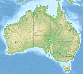
| Location | Queensland, Australia |
| Nearest city | Brisbane |
| Established | 1994 |
| Governing body | Queensland Parks and Wildlife Service |
| www | |
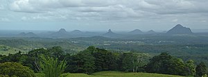
Glass House Mountains National Park is a national park in the Australian state of Queensland, 70 km (43 mi) north of Brisbane. It consists of a flat plain punctuated by rhyolite and trachyte volcanic plugs, the cores of extinct volcanoes that formed 27 million to 26 million years ago.[1][2] The mountains would once have had pyroclastic exteriors, but these have eroded away.
The park was established in 1994. On the 23 June 2010 the Queensland Government announced the expansion of the park to include an additional 2,117 hectares.
Origin of name
The Glass House Mountains were named by Captain James Cook as he sailed north up the coast of what is now Queensland in 1770 as part of his epic voyage aboard his ship HM Bark Endeavour.[3] They were so called as the shape of the mountains reminded him of the huge glass furnaces (glasshouses) back in his native Yorkshire.[4][5]
Peaks
The peaks rise prominently from the surrounding landscape and generally have steep sides.[6] The Glass House Mountains are:
- Mount Beerburrum, 276 m
- Mount Beerwah, 555 m
- Mount Coochin, 235 m
- Mount Coonowrin or Crookneck, 377 m
- Mount Elimbah or The Saddleback, 129 m
- Mount Miketeebumulgrai, 199 m
- Mount Ngungun, 253 m
- Round Mountain
- Mount Tibberoowuccum, 220 m
- Mount Tibrogargan, 364 m
- Mount Tunbubudla or the Twins, 312 and 293 m The twins are one mountain.
- Wild Horse Mountain, 123 m
Mount Beerwah is the highest peak within the park at 555 m (1,821 ft) however public access to the 'tourist track' in the National Park has been controversially restricted since 2009.[7] Mount Coonowrin 377 m (1,237 ft) is the second highest however public access to it has been prohibited since 1999 and Mount Tibrogargan at 364 m (1,194 ft) is the third highest which is fortunately open. Walking track allow access to the summits of Mount Beerwah, Mount Tibrogargan and Mount Ngungun, however climbing of Mount Coonowrin is prohibited due to the danger of trachyte rock stability.
Flora

The peaks support a diverse range of habitats including montane heath and shrubland, open forest and woodlands and small rainforest patches on some peaks. The montane heath is particularly rich in threatened and endemic species many of which can be found nowhere else. In total there are 26 species of rare vegetation on the heaths.[3] The Glasshouse Mountains Tea Tree Leptospermum leuhmanii is restricted to the peaks and is notable for its beautiful smooth orange bark. The Mount Beerwah Mallee Red Gum Eucalyptus kabiana is also endemic and is named after the local Aboriginal Tribe and traditional owners the Kabi Kabi (pronounced Gubbi Gubbi). Other endemic plants include Gonocarpus effusus, Grevillea hodgei, Westringia grandifolia and Leptospermum oreophyllum [8]
Facilities
Camp grounds are available at Coochin Creek, west of Beerwah.[6] Lookouts have been built at several of the summits. Access is via the Steve Irwin Way exit from the Bruce Highway.[6]
See also
References
- ^ Cohen B.E., Vasconcelos P.M., Knesel K.M. (2007) 40Ar/39Ar Constraints on the Timing of Oligocene Intraplate Volcanism in Southeast Queensland. Australian Journal of Earth Sciences, vol. 54, pages 105-125.
- ^ Knesel K. M., Cohen B.E., Vasconcelos P. M., and Thiede D.S. (2008) Rapid change in drift of the Australian plate records collision with Ontong Java Plateau, Nature vol 454, pp. 754-757.
- ^ a b Explore Queensland's National Parks. Prahran, Victoria: Explore Australia Publishing. 2008. pp. 14–15. ISBN 978-1-74117-245-4.
- ^ Glasshouse Mountains, Queensland
- ^ History of the Glasshouse Mountains
- ^ a b c Shilton, Peter (2005). Natural Areas of Queensland. Mount Gravatt, Queensland: Goldpress. pp. 160–162. ISBN 0-9758275-0-2.
{{cite book}}:|access-date=requires|url=(help) - ^ http://www.nprsr.qld.gov.au/park-alerts/11629.html
- ^ .Leiper, Glenn et al.(2008) Mangroves to Mountains: a field guide to the native plants of south-east Queensland - Society for Growing Australian Plants Logan River Branch, Browns Plains QLD.

