Araras: Difference between revisions
Appearance
Content deleted Content added
No edit summary |
A.amitkumar (talk | contribs) Reverted good faith edit(s) by Djuliox using STiki |
||
| Line 1: | Line 1: | ||
<ref>[[File:Fonte luminosa na Praça Barão de Araras com o Monumento ao Centenário ao fundo.JPG|Fonte luminosa na Praça Barão de Araras com o Monumento ao Centenário ao fundo]] |
|||
{{Infobox settlement |
{{Infobox settlement |
||
| name = Araras |
| name = Araras |
||
Revision as of 19:34, 31 May 2013
Araras | |
|---|---|
Municipality | |
| The Municipality of Campinas | |
| File:Ararasssp03.JPG | |
| Nickname: Cidade das árvores | |
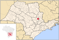
 Location of Araras | |
| Country | |
| Region | Southeast |
| State | São Paulo |
| Mesoregion | Piracicaba |
| Microregion | Limeira |
| Founded | August 15, 1862 |
| Government | |
| • Mayor | Nelson Dimas Brambilla (PT) |
| Area | |
• Total | 644.831 km2 (248.971 sq mi) |
| Elevation | 629 m (2,064 ft) |
| Population (2010)[1] | |
• Total | 118,843 |
| • Density | 180/km2 (480/sq mi) |
| Demonym | Ararense |
| Time zone | UTC-3 (Brasilia Official Time) |
| • Summer (DST) | UTC-2 (Brazilian Daylight Saving Time) |
| Postal Code | 13600-000 |
| Area code | (+55) 19 |
| Website | www |
Araras (Portuguese pronunciation: [ɐˈɾaɾɐs]) is a city and municipality located in the interior of State of São Paulo, Brazil. The population is 118,898 as of the 2010 IBGE Census.[1]
Etymology
Araras means macaws.
Sports
União São João Esporte Clube, founded in 1981, is the most successful football club of the city.[2]


