Hill of Allen: Difference between revisions
Per WP:INFOBOXFLAG |
m →Tower |
||
| Line 26: | Line 26: | ||
==Tower== |
==Tower== |
||
In 1859 Sir Gerard George Aylmer, the [[Aylmer baronets|9th Baronet of Donadea]] began building a circular tower on the top of the hill, which was completed in 1863. The tower was a folly and the names of the workmen are inscribed on the steps.<ref name="Allen"/> |
In 1859 Sir Gerard George Aylmer, the [[Aylmer baronets|9th Baronet of Donadea]] began building a circular tower on the top of the hill, which was completed in 1863. The tower was a [[folly]] and the names of the workmen are inscribed on the steps.<ref name="Allen"/> |
||
During the construction of the tower a large coffin containing human bones was unearthed which were said to be those of Fionn mac Cumhaill. These were re-interred under the site.<ref name="Kildare Times"/><ref>[http://www.kildare.ie/Heritage/History/miscellaneous/hill-of-allen.htm County Kildare Website - Hill of Allen]</ref> |
During the construction of the tower a large coffin containing human bones was unearthed which were said to be those of Fionn mac Cumhaill. These were re-interred under the site.<ref name="Kildare Times"/><ref>[http://www.kildare.ie/Heritage/History/miscellaneous/hill-of-allen.htm County Kildare Website - Hill of Allen]</ref> |
||
Revision as of 23:05, 9 September 2013
| Hill Of Allen | |
|---|---|
 Hill of Allen | |
| Highest point | |
| Elevation | 206 m (676 ft) |
| Coordinates | 53°13′46.19″N 6°51′47.92″W / 53.2294972°N 6.8633111°W |
| Naming | |
| Language of name | Irish |
| Geography | |
 | |
| Location | Kildare, Republic of Ireland |
| Parent range | Chair of Kildare |
| OSI/OSNI grid | N759205 |
| Topo map | OSi Discovery 49 |
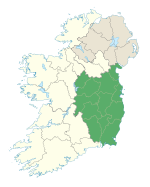
The Hill of Allen (Cnoc Alúine in Modern Irish, earlier Cnoc Almaine; also Hill of Almu [1]) is a volcanic hill situated in the west of County Kildare, Ireland, beside the village of Allen. According to Irish Mythology it was the seat of the hunter-warrior Fionn mac Cumhaill and the Fianna.[1] The site is currently part-owned by Roadstone Dublin Ltd.[2] and extensive quarrying has noticeably changed the profile of the hill.
History
The hill is situated at the easternmost point of the Bog of Allen and it is from this hill that the bog gets its name.[1] According to legend, Fionn mac Cumhaill had a fortress on the hill and used the surrounding flatlands as training grounds for his warriors. In 722 the Battle of Allen was fought between the Leinstermen (Laigin), led by Murchad mac Brain Mut (King of Leinster), and the forces of Fergal mac Máele Dúin (High King of Ireland) in close proximity to the hill.[3]
Tower
In 1859 Sir Gerard George Aylmer, the 9th Baronet of Donadea began building a circular tower on the top of the hill, which was completed in 1863. The tower was a folly and the names of the workmen are inscribed on the steps.[1]
During the construction of the tower a large coffin containing human bones was unearthed which were said to be those of Fionn mac Cumhaill. These were re-interred under the site.[2][4]
Quarry
As of 2008 most of the site is under the ownership of Roadstone Dublin Ltd. and much of the western side of the hill has been quarried.[5]
See also
References and notes
- ^ a b c d The Hill Of Allen Action Group Website
- ^ a b "'National Monuments' found on Hill of Allen". Kildare Nationalist. 2007-10-18. Retrieved 2008-07-21.
- ^ The Cycles of the Kings - Cath Almaine "The Battle of Allen"
- ^ County Kildare Website - Hill of Allen
- ^ Aerial photograph of effect of quarrying on the Hill of Allen


