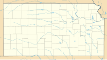
Rooks County Regional Airport: Difference between revisions
Appearance
Content deleted Content added
No edit summary |
|||
| Line 16: | Line 16: | ||
| coordinates_region = US-KS_scale:10000 |
| coordinates_region = US-KS_scale:10000 |
||
| pushpin_map = USA Kansas |
| pushpin_map = USA Kansas |
||
| pushpin_map_caption = Location |
| pushpin_map_caption = Location in Kansas |
||
| pushpin_label = '''RCP''' |
| pushpin_label = '''RCP''' |
||
| pushpin_label_position = right |
| pushpin_label_position = right |
||
| Line 25: | Line 25: | ||
}} |
}} |
||
'''Rooks County Regional Airport''' {{airport codes||KRCP|RCP}} is |
'''Rooks County Regional Airport''' {{airport codes||KRCP|RCP}} is in [[Rooks County, Kansas]]. Owned by the Rooks County Airport Commission, it is six miles south of [[Stockton, Kansas]]<ref name="FAA" /> and seven miles north of [[Plainville, Kansas]].<ref>{{cite web | url = http://rookscounty.net/airport.htm | title = Rooks County Regional Airport (RCP) | publisher = RooksCounty.net}}</ref> |
||
Most U.S. airports use the same three-letter [[location identifier]] for the [[Federal Aviation Administration|FAA]] and [[International Air Transport Association|IATA]], but this airport is RCP to the FAA<ref name="FAA" /> and has no IATA code. ([[Cinder River]], [[Alaska]] has IATA code RCP.) |
|||
== |
==Facilities== |
||
The airport covers 459 [[acre]]s (186 [[hectare|ha]]) at an [[elevation]] of 1,998 feet (609 m). Its one [[runway]], 18/36, is 5,000 by 75 feet (1,524 x 23 m) concrete.<ref name="FAA" /> |
|||
== References == |
== References == |
||
Revision as of 22:40, 13 March 2014
Rooks County Regional Airport | |||||||||||
|---|---|---|---|---|---|---|---|---|---|---|---|
| Summary | |||||||||||
| Airport type | Public | ||||||||||
| Owner | Rooks County Airport Commission | ||||||||||
| Serves | Stockton, Kansas | ||||||||||
| Elevation AMSL | 1,998 ft / 609 m | ||||||||||
| Website | RooksCounty.net/... | ||||||||||
| Map | |||||||||||
 | |||||||||||
| Runways | |||||||||||
| |||||||||||
Rooks County Regional Airport (ICAO: KRCP, FAA LID: RCP) is in Rooks County, Kansas. Owned by the Rooks County Airport Commission, it is six miles south of Stockton, Kansas[1] and seven miles north of Plainville, Kansas.[2]
Most U.S. airports use the same three-letter location identifier for the FAA and IATA, but this airport is RCP to the FAA[1] and has no IATA code. (Cinder River, Alaska has IATA code RCP.)
Facilities
The airport covers 459 acres (186 ha) at an elevation of 1,998 feet (609 m). Its one runway, 18/36, is 5,000 by 75 feet (1,524 x 23 m) concrete.[1]
References
- ^ a b c d FAA Airport Form 5010 for RCP PDF. Federal Aviation Administration. Effective May 31, 2012.
- ^ "Rooks County Regional Airport (RCP)". RooksCounty.net.
External links
- Rooks County Regional Airport (RCP) at Rooks County website
- Resources for this airport:
- FAA airport information for RCP
- AirNav airport information for RCP
- FlightAware airport information and live flight tracker
- SkyVector aeronautical chart for RCP

