Greater Iqbal Park: Difference between revisions
No edit summary |
No edit summary |
||
| Line 17: | Line 17: | ||
|coordinates_display= title |
|coordinates_display= title |
||
}} |
}} |
||
'''Iqbal Park''' (formerly '''Minto Park''') is large area of green space, located at the heart of [[Lahore]] city in [[Pakistan]].<ref>{{cite web|url=http://gulftoday.ae/portal/50bcdf70-a028-40cd-a1b9-c549d2ee39fa.aspx |title=Bury the hatchet|publisher=gulftoday.ae |date= |accessdate=2012-03-23|author=Zafar Iqbal}}</ref> The park accommodates ''[[Minar-e-Pakistan]]'' ([[Minaret|Lighthouse]] of Pakistan), a 60 meters (198.5 feet) tall distinctive [[monument]] in the shape of a [[minaret]] that has been built in commemoration of the [[Lahore Resolution]] passed at the three-day general session (22–24 March 1940) of [[All India Muslim League]], calling for greater [[Muslim]] autonomy in [[British India]]. The resolution became synonymous to the demand for a separate Muslim state of Pakistan. |
'''Iqbal Park''' (formerly '''Minto Park''') is large area of green space, located at the heart of [[Lahore]] city in [[Pakistan]].<ref>{{cite web|url=http://gulftoday.ae/portal/50bcdf70-a028-40cd-a1b9-c549d2ee39fa.aspx |title=Bury the hatchet|publisher=gulftoday.ae |date= |accessdate=2012-03-23|author=Zafar Iqbal}}</ref> The park accommodates ''[[Minar-e-Pakistan]]'' ([[Minaret|Lighthouse]] of Pakistan), a 60 meters (198.5 feet) tall distinctive [[monument]] in the shape of a [[minaret]] that has been built in commemoration of the [[Lahore Resolution]] passed at the three-day general session (22–24 March 1940) of [[All India Muslim League]], calling for greater [[Muslim]] autonomy in [[British India]]. The resolution became synonymous to the demand for a separate Muslim state of Pakistan. The park has been expanded in May 2014 and now includes [[Minar-e-Pakistan]], [[Lahore Fort]] and [[Badshahi Mosque]] which are now part of park as well . More than 93 acres land has been added to the area of the park during expansion. |
||
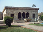
[[Image:Bara_Dari_South_facing_side_of_the_12_Door_Building_July_1_2005.jpg|thumb|right|250px|Hazuri Bagh with the [[Hazuri Bagh Baradari|Baradari]] at its center in Iqbal Park]] |
[[Image:Bara_Dari_South_facing_side_of_the_12_Door_Building_July_1_2005.jpg|thumb|right|250px|Hazuri Bagh with the [[Hazuri Bagh Baradari|Baradari]] at its center in Iqbal Park]] |
||
<center> |
<center> |
||
<gallery widths=140 heights=105> |
<gallery widths=140 heights=105> |
||
File:Minar -e Pakistan at Night.jpeg|[[Minar-e-Pakistan]], a public monument is located in Iqbal Park. |
|||
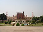
Badshahi Mosque July 1 2005 pic32 by Ali Imran (1).jpg|[[Badshahi Mosque is present in Iqbal Park. |
|||
| ⚫ | |||
| ⚫ | |||
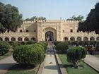
iqbal park entrance.jpg|Entering the Park |
iqbal park entrance.jpg|Entering the Park |
||
iqbal park lush grounds.jpg|Lush grounds |
iqbal park lush grounds.jpg|Lush grounds |
||
| ⚫ | |||
Image:Shahi Mosque 2.jpg|[[Hazuri Bagh Baradari]] in foreground |
Image:Shahi Mosque 2.jpg|[[Hazuri Bagh Baradari]] in foreground |
||
Image:The Hazuri Bagh Pavilion(1870).jpg|Hazuri bagh pavilion in 1870, with [[Lahore Fort]] in background |
|||
Image:Hazuri_Bagh.JPG|South section, with Roshnai Gate in background |
Image:Hazuri_Bagh.JPG|South section, with Roshnai Gate in background |
||
| ⚫ | |||
Image:Bara Dari East & North facing sides of The 12 door building July 1 2005.jpg|Baradari with [[Badshahi Mosque]] in background in Iqbal Park |
Image:Bara Dari East & North facing sides of The 12 door building July 1 2005.jpg|Baradari with [[Badshahi Mosque]] in background in Iqbal Park |
||
Revision as of 08:57, 24 June 2014
This article has multiple issues. Please help improve it or discuss these issues on the talk page. (Learn how and when to remove these messages)
No issues specified. Please specify issues, or remove this template. |
File:
| Iqbal Park | |
|---|---|
 | |
| Lua error in Module:Location_map at line 526: Unable to find the specified location map definition: "Module:Location map/data/Lahore" does not exist. | |
| General information | |
| Location | Lahore, Pakistan |
Iqbal Park (formerly Minto Park) is large area of green space, located at the heart of Lahore city in Pakistan.[3] The park accommodates Minar-e-Pakistan (Lighthouse of Pakistan), a 60 meters (198.5 feet) tall distinctive monument in the shape of a minaret that has been built in commemoration of the Lahore Resolution passed at the three-day general session (22–24 March 1940) of All India Muslim League, calling for greater Muslim autonomy in British India. The resolution became synonymous to the demand for a separate Muslim state of Pakistan. The park has been expanded in May 2014 and now includes Minar-e-Pakistan, Lahore Fort and Badshahi Mosque which are now part of park as well . More than 93 acres land has been added to the area of the park during expansion.

-
Minar-e-Pakistan, a public monument is located in Iqbal Park.
-
[[Badshahi Mosque is present in Iqbal Park.
-
The Lahore Fort is located in Iqbal Park.
-
Hazuri Bagh Baradari in Iqbal Park
-
Entering the Park
-
Lush grounds
-
Hazuri Bagh Baradari in foreground
-
South section, with Roshnai Gate in background
-
Baradari with Badshahi Mosque in background in Iqbal Park
-
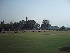
View of Iqbal Park
-
Diwan-e-Khas: Hall of Special Audience
-
Diwan-e-Aam: Hall of Public Audience
-
Alamgiri Gate in front of the fort
-
Hazuri Bagh Baradari with Lahore Fort in the background, 2005
-
View of Badshahi Mosque in Iqbal Park
-
The Lahore Fort-Sleeping chambers of Shahjahan
-
View of Samadhi of Ranjit Singh
-
Minar-e-Pakistan
-
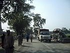
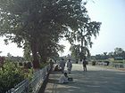
Street scene
-
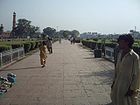
Walking trail
-
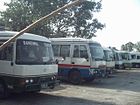
Tourist buses
See also
- List of parks and gardens in Pakistan
- List of parks and gardens in Lahore
- List of parks and gardens in Karachi
References
- ^ Cite error: The named reference
developmentwas invoked but never defined (see the help page). - ^ http://www.tdcp.gop.pk/tdcp/Accomodation/TDCPResortsStopovers/tabid/639/Default.aspx
- ^ Zafar Iqbal. "Bury the hatchet". gulftoday.ae. Retrieved 23 March 2012.
31°35′29.0″N 74°18′31.5″E / 31.591389°N 74.308750°E


