Fejér County: Difference between revisions
m →History |
No edit summary |
||
| Line 3: | Line 3: | ||
<!-- See Template:Infobox settlement for additional fields and descriptions --> |
<!-- See Template:Infobox settlement for additional fields and descriptions --> |
||
| name = Fejér County |
| name = Fejér County |
||
| image_skyline = |
| image_skyline = Hollandi-ház (3601. számú műemlék) 4.jpg |
||
| image_flag = FLAG-Fejér-megye.svg |
| image_flag = FLAG-Fejér-megye.svg |
||
| image_shield = |
| image_shield = BlasonHU-fejer.svg |
||
| image_map = |
| image_map = HU county Fejer.svg |
||
| subdivision_type = [[List of sovereign states|Country]] |
| subdivision_type = [[List of sovereign states|Country]] |
||
| subdivision_name = [[Hungary]] |
| subdivision_name = [[Hungary]] |
||
Revision as of 20:56, 2 December 2014
You can help expand this article with text translated from the corresponding article in Hungarian. (August 2012) Click [show] for important translation instructions.
|
Fejér County | |
|---|---|
 | |
 | |
| Country | Hungary |
| Region | Central Transdanubia |
| County seat | Székesfehérvár |
| Area | |
• Total | 4,358.45 km2 (1,682.81 sq mi) |
| Population (2011 census) | |
• Total | 425,847 |
| • Density | 98/km2 (250/sq mi) |
| Website | www |
- For the historical county see Fejér (former county).
- For the mathematician of the same name see Lipót Fejér
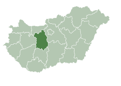
Fejér (Hungarian pronunciation: [ˈfɛjeːr]) is the name of an administrative county (comitatus or megye) in Central Hungary. It lies on the west bank of the river Danube and nearly touches the eastern shore of Lake Balaton. It shares borders with the Hungarian counties Veszprém, Komárom-Esztergom, Pest, Bács-Kiskun, Tolna and Somogy. The capital of Fejér county is Székesfehérvár.
Geography
Geographically, Fejér County is very diverse; its southern part is similar (and adjacent) to the Great Hungarian Plain, and other parts are hilly (Bakony, Vértes, Gerecse mountains). Lake Velence, a popular resort can also be found here.
History
Before the Conquest
The area was already inhabited 20,000 years ago. When this part of Hungary formed a Roman province called Pannonia, several settlements stood here: the capital was Gorsium, but there were other significant towns too, where present-day Baracs and Dunaújváros are (the towns were called Annamatia and Intercisa, respectively). In the early Medieval period Huns and Avars lived in the area. After 586 several nomadic people inhabited in the area, until Hungarians conquered it in the late 9th century.
From the Conquest until the Ottoman occupation
Hungarians arrived in the area between 895 and 900. The high prince and his tribe settled down in this area. The town of Fehérvár (modern-day Székesfehérvár) became significant as the seat of Prince Géza. Under the reign of his son, King Stephen, the town became the county seat of the newly formed county. Kings of Hungary were crowned and buried in the town until the 16th century.
Fejér under Ottoman rule
Fejér county was occupied by Ottomans between 1543 and 1688. Several of the villages were destroyed, the population dramatically decreased. After being freed from Ottoman rule, local administration was reorganized in 1692. Székesfehérvár got back its town status only in 1703.
Regional structure
Cities with county rights

- Székesfehérvár (county seat)
- Dunaújváros
Towns
(ordered by population, according to the 2001 census)
- Mór (14,731)
- Sárbogárd (13,461)
- Bicske (11,103)
- Ercsi (8,406)
- Gárdony (8,127)
- Enying (7,191)
- Polgárdi (6,582)
- Pusztaszabolcs (6,223)
- Martonvásár (5,180)
- Velence (4,845)
- Rácalmás (4,425)
- Bodajk (4,142)
- Adony (3,823)
Villages
|
Gallery
-
Gorsium-Tác from above
-
Aerial Photo: Seregélyes - Palace
-
Lovasberény - Palace
-
Nádasdladány - Palace
-
Aerial photo: Dég - Palace
-
Holy Cross Lesser Church in Mór
-
Bakonycsernye
-
Bory Castle
-
Tac, Gorsium
-
Zichyújfalu - Palace


