
Government Camp, Oregon: Difference between revisions
added elevation |
Made climate box |
||
| Line 84: | Line 84: | ||
==Government== |
==Government== |
||
Over the last decade,{{When|date=February 2011}} Government Camp went through a revitalization effort due to a Clackamas County [[urban renewal]] district. With that district expiring in 2007, the community had been looking at ways to maintain current services. At a town hall meeting on November 17, 2006, citizens voted not to form a [[village (Oregon)|village]] 41-58.<ref name="sp inc">{{cite news|url=http://www.sandypost.com/news/story.php?story_id=127483700333447300|title=Government Camp voters reject new city|last=Guibord|first=Garth|date=May 25, 2010|work=The Sandy Post|publisher=Pamplin Media Group|accessdate=14 June 2010}}</ref> Many residents voted against the proposal in order to seek [[Municipal corporation|incorporation]].<ref>[http://www.sandypost.com/news/story.php?story_id=116423851212380100 Government Camp voters reject village proposal] ''SandyPost.com''</ref> In May 2010, residents of the community voted on incorporation,<ref>{{cite news|url=http://www.oregonlive.com/clackamascounty/index.ssf/2010/05/government_camp_voters_will_de.html|title=Government Camp voters will decide whether to incorporate|last=Tims|first=Dana|date=May 1, 2010|work=[[The Oregonian]]|accessdate=5 May 2010}}</ref> but the measure failed by a vote of 48 against incorporation and 35 in favor of incorporation.<ref>{{cite news|url=http://www.oregonlive.com/clackamascounty/index.ssf/2010/05/government_camp_election_resul.html|title=Government Camp incorporation measure fails|date=May 19, 2010|work=The Oregonian|accessdate=14 June 2010}}</ref> Had the city been formed, the city would have had 138 registered voters within the city limits at the time of formation.<ref name="sp inc"/> |
Over the last decade,{{When|date=February 2011}} Government Camp went through a revitalization effort due to a Clackamas County [[urban renewal]] district. With that district expiring in 2007, the community had been looking at ways to maintain current services. At a town hall meeting on November 17, 2006, citizens voted not to form a [[village (Oregon)|village]] 41-58.<ref name="sp inc">{{cite news|url=http://www.sandypost.com/news/story.php?story_id=127483700333447300|title=Government Camp voters reject new city|last=Guibord|first=Garth|date=May 25, 2010|work=The Sandy Post|publisher=Pamplin Media Group|accessdate=14 June 2010}}</ref> Many residents voted against the proposal in order to seek [[Municipal corporation|incorporation]].<ref>[http://www.sandypost.com/news/story.php?story_id=116423851212380100 Government Camp voters reject village proposal] ''SandyPost.com''</ref> In May 2010, residents of the community voted on incorporation,<ref>{{cite news|url=http://www.oregonlive.com/clackamascounty/index.ssf/2010/05/government_camp_voters_will_de.html|title=Government Camp voters will decide whether to incorporate|last=Tims|first=Dana|date=May 1, 2010|work=[[The Oregonian]]|accessdate=5 May 2010}}</ref> but the measure failed by a vote of 48 against incorporation and 35 in favor of incorporation.<ref>{{cite news|url=http://www.oregonlive.com/clackamascounty/index.ssf/2010/05/government_camp_election_resul.html|title=Government Camp incorporation measure fails|date=May 19, 2010|work=The Oregonian|accessdate=14 June 2010}}</ref> Had the city been formed, the city would have had 138 registered voters within the city limits at the time of formation.<ref name="sp inc"/> |
||
==Climate== |
|||
{{Weather box |
|||
|location = 1951-2005 Government Camp, Oregon. |
|||
|single line = Y |imperial first = Y |
|||
|Jan high F = 35.6 |
|||
|Feb high F = 38.4 |
|||
|Mar high F = 40.7 |
|||
|Apr high F = 45.3 |
|||
|May high F = 52.8 |
|||
|Jun high F = 59.4 |
|||
|Jul high F = 68.2 |
|||
|Aug high F = 68.3 |
|||
|Sep high F = 63.2 |
|||
|Oct high F = 53.7 |
|||
|Nov high F = 41.3 |
|||
|Dec high F = 36.6 |
|||
|year high F = 50.3 |
|||
|Jan low F = 24.1 |
|||
|Feb low F = 25.4 |
|||
|Mar low F = 26.9 |
|||
|Apr low F = 29.9 |
|||
|May low F = 35.0 |
|||
|Jun low F = 40.6 |
|||
|Jul low F = 45.9 |
|||
|Aug low F = 46.2 |
|||
|Sep low F = 42.4 |
|||
|Oct low F = 36.2 |
|||
|Nov low F = 29.2 |
|||
|Dec low F = 25.2 |
|||
|year low F = 33.9 |
|||
|Jan precipitation inch = 13.19 |
|||
|Feb precipitation inch = 9.64 |
|||
|Mar precipitation inch = 8.94 |
|||
|Apr precipitation inch = 7.24 |
|||
|May precipitation inch = 5.27 |
|||
|Jun precipitation inch = 3.88 |
|||
|Jul precipitation inch = 1.11 |
|||
|Aug precipitation inch = 1.63 |
|||
|Sep precipitation inch = 3.49 |
|||
|Oct precipitation inch = 7.05 |
|||
|Nov precipitation inch = 11.87 |
|||
|Dec precipitation inch = 13.79 |
|||
|year precipitation inch = 87.10 |
|||
|Jan snow inch = 58.8 |
|||
|Feb snow inch = 41.5 |
|||
|Mar snow inch = 46.6 |
|||
|Apr snow inch = 25.1 |
|||
|May snow inch = 6.9 |
|||
|Jun snow inch = 0.6 |
|||
|Jul snow inch = 0.0 |
|||
|Aug snow inch = 0.0 |
|||
|Sep snow inch = 0.2 |
|||
|Oct snow inch = 5.5 |
|||
|Nov snow inch = 31.3 |
|||
|Dec snow inch = 50.6 |
|||
|year snow inch = 267.1 |
|||
|source 1 = The Western Regional Climate Center<ref name="WRCC">{{cite web |
|||
| url =http://www.wrcc.dri.edu/cgi-bin/cliMAIN.pl?orgove| title =Seasonal Temperature and Precipitation Information | accessdate =March 29, 2013 | publisher =Western Regional Climate Center | language = }}</ref>|date=March 2013}} |
|||
== See also== |
== See also== |
||
Revision as of 20:55, 5 March 2015
Government Camp | |
|---|---|
 Center of business district in Government Camp | |
| Country | United States |
| State | Oregon |
| County | Clackamas |
| Elevation | 4,416 ft (1,346 m) |
| Population (2010) | |
• Total | 193 |
| Time zone | UTC-8 (Pacific (PST)) |
| • Summer (DST) | UTC-7 (PDT) |

Government Camp is an unincorporated community located in Clackamas County, Oregon, United States, south of Mount Hood and north of Tom, Dick and Harry Mountain. It is the only town within five miles of Mount Hood and therefore it is the de facto "mountain town." It is a gateway to several ski resorts, the most popular being Timberline Lodge and Mount Hood Skibowl. Also, Government Camp has its own, smaller ski resort, Summit Ski Area. And, somewhat farther, there is another very popular resort, Mount Hood Meadows.
The community is located within the Mount Hood Corridor on U.S. Route 26 (aka the Mount Hood Scenic Byway), near its intersection with Oregon Route 35 and the Barlow Pass summit of the Cascade Range.
Government Camp was given its name by settlers traveling the Barlow Road, who discovered several wagons abandoned there by the Regiment of Mounted Riflemen.
Government
Over the last decade,[when?] Government Camp went through a revitalization effort due to a Clackamas County urban renewal district. With that district expiring in 2007, the community had been looking at ways to maintain current services. At a town hall meeting on November 17, 2006, citizens voted not to form a village 41-58.[1] Many residents voted against the proposal in order to seek incorporation.[2] In May 2010, residents of the community voted on incorporation,[3] but the measure failed by a vote of 48 against incorporation and 35 in favor of incorporation.[4] Had the city been formed, the city would have had 138 registered voters within the city limits at the time of formation.[1]
Climate
| Climate data for 1951-2005 Government Camp, Oregon. | |||||||||||||
|---|---|---|---|---|---|---|---|---|---|---|---|---|---|
| Month | Jan | Feb | Mar | Apr | May | Jun | Jul | Aug | Sep | Oct | Nov | Dec | Year |
| Mean daily maximum °F (°C) | 35.6 (2.0) |
38.4 (3.6) |
40.7 (4.8) |
45.3 (7.4) |
52.8 (11.6) |
59.4 (15.2) |
68.2 (20.1) |
68.3 (20.2) |
63.2 (17.3) |
53.7 (12.1) |
41.3 (5.2) |
36.6 (2.6) |
50.3 (10.2) |
| Mean daily minimum °F (°C) | 24.1 (−4.4) |
25.4 (−3.7) |
26.9 (−2.8) |
29.9 (−1.2) |
35.0 (1.7) |
40.6 (4.8) |
45.9 (7.7) |
46.2 (7.9) |
42.4 (5.8) |
36.2 (2.3) |
29.2 (−1.6) |
25.2 (−3.8) |
33.9 (1.1) |
| Average precipitation inches (mm) | 13.19 (335) |
9.64 (245) |
8.94 (227) |
7.24 (184) |
5.27 (134) |
3.88 (99) |
1.11 (28) |
1.63 (41) |
3.49 (89) |
7.05 (179) |
11.87 (301) |
13.79 (350) |
87.10 (2,212) |
| Average snowfall inches (cm) | 58.8 (149) |
41.5 (105) |
46.6 (118) |
25.1 (64) |
6.9 (18) |
0.6 (1.5) |
0.0 (0.0) |
0.0 (0.0) |
0.2 (0.51) |
5.5 (14) |
31.3 (80) |
50.6 (129) |
267.1 (678) |
| Source: The Western Regional Climate Center[5] | |||||||||||||
See also
References
- ^ a b Guibord, Garth (May 25, 2010). "Government Camp voters reject new city". The Sandy Post. Pamplin Media Group. Retrieved 14 June 2010.
- ^ Government Camp voters reject village proposal SandyPost.com
- ^ Tims, Dana (May 1, 2010). "Government Camp voters will decide whether to incorporate". The Oregonian. Retrieved 5 May 2010.
- ^ "Government Camp incorporation measure fails". The Oregonian. May 19, 2010. Retrieved 14 June 2010.
- ^ "Seasonal Temperature and Precipitation Information". Western Regional Climate Center. Retrieved March 29, 2013.
External links
- Government Camp Village, with map from the Clackamas County Dep't of Transportation and Development
- Mt Hood Cultural Center & Museum
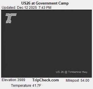
- Webcam of U.S. 26 road conditions near Government Camp, from Oregon Department of Transportation
Municipalities and communities of Clackamas County, Oregon, United States | ||
|---|---|---|
| Cities |  | |
| Hamlets | ||
| CDPs | ||
| Other communities |
| |
| Indian reservation | ||
| Footnotes | ‡This populated place also has portions in an adjacent county or counties | |
This Clackamas County, Oregon state location article is a stub. You can help Wikipedia by expanding it. |