Embu Airport: Difference between revisions
m Reverted edits by 104.229.11.89 (talk) (HG) |
Funandtrvl (talk | contribs) mos:layout |
||
| Line 38: | Line 38: | ||
}} |
}} |
||
'''Embu Airport''' is an airport [[Kenya]]. |
'''Embu Airport''' is an [[airport]] in [[Kenya]]. |
||
==Location== |
==Location== |
||
| Line 51: | Line 51: | ||
==Scheduled airlines and destinations== |
==Scheduled airlines and destinations== |
||
{{Empty section|date=February 2013}} |
{{Empty section|date=February 2013}} |
||
| ⚫ | |||
| ⚫ | |||
| ⚫ | |||
| ⚫ | |||
| ⚫ | |||
==See also== |
==See also== |
||
| Line 70: | Line 63: | ||
==References== |
==References== |
||
{{reflist}} |
{{reflist}} |
||
| ⚫ | |||
| ⚫ | |||
| ⚫ | |||
| ⚫ | |||
| ⚫ | |||
| ⚫ | |||
| ⚫ | |||
{{coord|0.568890|S|37.492221|E|display=title|type:airport}} |
{{coord|0.568890|S|37.492221|E|display=title|type:airport}} |
||
[[Category:Airports in Kenya]] |
[[Category:Airports in Kenya]] |
||
| ⚫ | |||
[[Category:Eastern Province (Kenya)]] |
[[Category:Eastern Province (Kenya)]] |
||
| ⚫ | |||
Revision as of 19:34, 2 April 2015
Embu Airport | |||||||||||
|---|---|---|---|---|---|---|---|---|---|---|---|
| Summary | |||||||||||
| Airport type | Public, Civilian | ||||||||||
| Owner | Kenya Airports Authority | ||||||||||
| Operator | Kenya Airports Authority | ||||||||||
| Serves | Embu | ||||||||||
| Location | Embu, | ||||||||||
| Elevation AMSL | 4,150 ft / 1,265 m | ||||||||||
| Coordinates | 00°34′08″S 37°29′32″E / 0.56889°S 37.49222°E | ||||||||||
 | |||||||||||
| Runways | |||||||||||
| |||||||||||
Embu Airport is an airport in Kenya.
Location
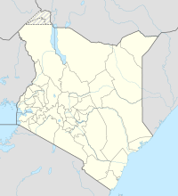
Embu Airport, (IATA: n/a, ICAO: HKEM), is located in Embu County, Embu District, Eastern Province, in the town of Embu.
Located about 6 kilometres (3.7 mi), by road, southeast of Embu's central business district, the airport lies to the immediate northeast of Donbosco Boys' Secondary School, on Embu-Kiritiri Road.
This location lies approximately 108 kilometres (67 mi), by air, northeast of Nairobi International Airport, the country's largest civilian airport.[1] The geographic coordinates of this airport are:0° 34' 8.00"S, 37° 29' 32.00"E (Latitude:0.568890; Longitude:37.492221).
Overview
Embu Airport is a small civilian airport, serving the town of Embu and surrounding communities. Situated at 1,265 metres (4,150 ft) above sea level, the airport has a single asphalt runway 14-32 which measures 3,250 feet (990 m) in length.[2]
Scheduled airlines and destinations
This section is empty. You can help by adding to it. (February 2013) |
See also
- Embu
- Embu District
- Eastern Province (Kenya)
- Kenya Airports Authority
- Kenya Civil Aviation Authority
- List of airports in Kenya

