Otročín: Difference between revisions
Appearance
Content deleted Content added
m Robot: Include commonscat template |
m Moving iw-ref to talk page per TfD outcome |
||
| Line 82: | Line 82: | ||
==Notes== |
==Notes== |
||
*{{translation/ref|cs|Otročín}} |
|||
{{Karlovy Vary District}} |
{{Karlovy Vary District}} |
||
Revision as of 19:45, 14 April 2015
Otročín | |
|---|---|
Municipality and village | |
 | |
| Country | |
| Region | Karlovy Vary Region |
| District | Karlovy Vary District |
| Area | |
• Total | 13.83 sq mi (35.82 km2) |
| Elevation | 2,073 ft (632 m) |
| Population (2011) | |
• Total | 525 |
| Time zone | UTC+1 (CET) |
| • Summer (DST) | UTC+2 (CEST) |
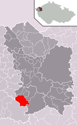
Otročín (Template:Lang-de) is a village and municipality in Karlovy Vary District in the Karlovy Vary Region of the Czech Republic.
Notes
50°1′55.7″N 12°53′29.1″E / 50.032139°N 12.891417°E
Wikimedia Commons has media related to Otročín.


