Kodak, Tennessee: Difference between revisions
Appearance
Content deleted Content added
→References: {{Eastman Kodak}} |
BrineStans (talk | contribs) +image |
||
| Line 7: | Line 7: | ||
<!-- Images --> |
<!-- Images --> |
||
|image_skyline = |
|image_skyline = Kodak-Trade-Center-tn1.jpg |
||
|imagesize = |
|imagesize = 250px |
||
|image_caption = |
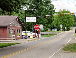
|image_caption = Intersection of Douglas Dam Road (TN-139) and Kodak Road in Kodak |
||
|image_flag = |
|image_flag = |
||
|image_seal = |
|image_seal = |
||
Revision as of 15:54, 19 May 2015
Kodak | |
|---|---|
 Intersection of Douglas Dam Road (TN-139) and Kodak Road in Kodak | |
| Country | United States |
| State | State of Tennessee |
| County | Sevier County |
| Elevation | 896 ft (273 m) |
| Time zone | UTC-5 (Eastern Time Zone) |
| • Summer (DST) | UTC-4 (EDT) |
| ZIP code | 37764 |
| Area code | 865 |
| GNIS feature ID | 1290403[1] |
Kodak is an Unincorporated community in Sevier County, Tennessee. Kodak is located along State Highway 139, just west of State Highway 66, and just south of Interstate Highway 40 and Knoxville, Tennessee. The elevation of Kodak is about 896 feet (273 meters) above sea level.
Kodak was named in 1892 when the local postmaster, Harvey N. Underwood, learned of the new "Kodak" brand of camera. Underwood decided that this was a name that was easy to remember and spell, hence he sought permission from the founder of Eastman Kodak, George Eastman, to use this name for his village and its post office. Eastman granted this permission.[2][3]
References

