100 Peaks of Taiwan: Difference between revisions
Added pictures |
Added pictures |
||
| Line 31: | Line 31: | ||
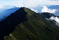
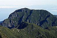
|align ="center"|8||[[Nanhu Mountain|Nanhudashan]]||align ="center"|3742 m<br>12277 ft||[[Taichung City]]||align ="center"|[[Taroko National Park|Taroko]]||align="center"|Big Five #4{{efn|group=Lists|name=BigFive}}||align="center"|[[File:NanhuMountain 02.jpg|200px]] |
|align ="center"|8||[[Nanhu Mountain|Nanhudashan]]||align ="center"|3742 m<br>12277 ft||[[Taichung City]]||align ="center"|[[Taroko National Park|Taroko]]||align="center"|Big Five #4{{efn|group=Lists|name=BigFive}}||align="center"|[[File:NanhuMountain 02.jpg|200px]] |
||
|- |
|- |
||
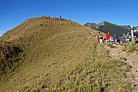
|align ="center"|9||[[Dongxiaonanshan]]||align ="center"|3711 m<br>12175 ft||[[Kaohsiung City]]||align ="center"|[[Yushan National Park|Yushan]]||align="center"|Level Nine #1{{efn|group=Lists|name=LevelNine|Wide, flat peaks without large rocks or trees, only short bamboo. Comfortable, easy walking.<ref name="Groups" /><ref name="EastNews" />}}|| |
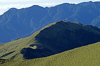
|align ="center"|9||[[Dongxiaonanshan]]||align ="center"|3711 m<br>12175 ft||[[Kaohsiung City]]||align ="center"|[[Yushan National Park|Yushan]]||align="center"|Level Nine #1{{efn|group=Lists|name=LevelNine|Wide, flat peaks without large rocks or trees, only short bamboo. Comfortable, easy walking.<ref name="Groups" /><ref name="EastNews" />}}||align="center"|[[File:Dongxiaonanshan.JPG|200px]] |
||
|- |
|- |
||
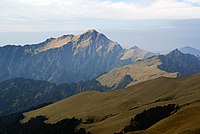
|align ="center"|10||[[Central Range Point|Zhongyangjianshan]]||align ="center"|3705 m<br>12156 ft||[[Taichung City]], [[Hualien County]]||align ="center"|[[Taroko National Park|Taroko]]||align ="center"|Pointy Three #1{{efn|group=Lists|name=PointyThree|These are three well-known mountains with distinct pyramid-like peaks.<ref name="Groups" />}}|| |
|align ="center"|10||[[Central Range Point|Zhongyangjianshan]]||align ="center"|3705 m<br>12156 ft||[[Taichung City]], [[Hualien County]]||align ="center"|[[Taroko National Park|Taroko]]||align ="center"|Pointy Three #1{{efn|group=Lists|name=PointyThree|These are three well-known mountains with distinct pyramid-like peaks.<ref name="Groups" />}}||align="center"|[[File:Zhongyangjianshan.JPG|200px]] |
||
|- |
|- |
||
|align ="center"|11||[[Xueshan North Peak]]{{efn-lr|Other names: Yuliyulishan}}||align ="center"|3703 m<br>12149 ft||[[Miaoli County]], [[Taichung City]]||align ="center"|[[Shei-Pa National Park|Shei-Pa]]||align ="center"|Gentle Ten #2{{efn|group=Lists|name=GentleTen|These mountains have an overall smooth profile, with gentle slopes and little climbing or scrambling needed.<ref name="Groups" />}}||align="center"|[[File:HsuehMountainNorthenPeak.jpg|200px]] |
|align ="center"|11||[[Xueshan North Peak]]{{efn-lr|Other names: Yuliyulishan}}||align ="center"|3703 m<br>12149 ft||[[Miaoli County]], [[Taichung City]]||align ="center"|[[Shei-Pa National Park|Shei-Pa]]||align ="center"|Gentle Ten #2{{efn|group=Lists|name=GentleTen|These mountains have an overall smooth profile, with gentle slopes and little climbing or scrambling needed.<ref name="Groups" />}}||align="center"|[[File:HsuehMountainNorthenPeak.jpg|200px]] |
||
| Line 89: | Line 89: | ||
|align ="center"|37||[[Hehuanshan Main Peak]]||align ="center"|3417 m<br>11211 ft||[[Nantou County]]||align ="center"|[[Taroko National Park|Taroko]]||align ="center"|Gentle Ten #3{{efn|group=Lists|name=GentleTen}}|| |
|align ="center"|37||[[Hehuanshan Main Peak]]||align ="center"|3417 m<br>11211 ft||[[Nantou County]]||align ="center"|[[Taroko National Park|Taroko]]||align ="center"|Gentle Ten #3{{efn|group=Lists|name=GentleTen}}|| |
||
|- |
|- |
||
|align ="center"|38||[[South Yushan]]||align ="center"|3383 m<br>11099 ft||[[Kaohsiung City]]||align ="center"|[[Yushan National Park|Yushan]]||align ="center"|Gentle Ten #4{{efn|group=Lists|name=GentleTen}}|| |
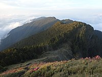
|align ="center"|38||[[South Yushan]]||align ="center"|3383 m<br>11099 ft||[[Kaohsiung City]]||align ="center"|[[Yushan National Park|Yushan]]||align ="center"|Gentle Ten #4{{efn|group=Lists|name=GentleTen}}||align="center"|[[File:South Yushan.JPG|200px]] |
||
|- |
|- |
||
|align ="center"|39||[[Bilushan]]{{efn-lr|Other names: Lagashan}}||align ="center"|3371 m<br>11060 ft||[[Hualien County]], [[Nantou County]]||align ="center"|[[Taroko National Park|Taroko]]||align ="center"|Narrow Eight #3{{efn|group=Lists|name=NarrowEight|These mountains have long narrow ridgelines with cliffs or steep slopes on both sides.<ref name="Groups" />}}|| |
|align ="center"|39||[[Bilushan]]{{efn-lr|Other names: Lagashan}}||align ="center"|3371 m<br>11060 ft||[[Hualien County]], [[Nantou County]]||align ="center"|[[Taroko National Park|Taroko]]||align ="center"|Narrow Eight #3{{efn|group=Lists|name=NarrowEight|These mountains have long narrow ridgelines with cliffs or steep slopes on both sides.<ref name="Groups" />}}|| |
||
| Line 181: | Line 181: | ||
|align ="center"|83||[[Shemazhenshan]]{{efn-lr|Other names: Yezhenjialuosuishan}}||align ="center"|3141 m<br>10305 ft||[[Yilan County]], [[Taichung City]]||align ="center"|[[Taroko National Park|Taroko]]||align ="center"|Contiguous Six #1{{efn|group=Lists|name=ContiguousSix|These peaks are near other high peaks, and can be reached along a ridge that extends down from the higher peak. They have fairly level trails, the peaks are named and there is some sort of survey marker. <ref name="Groups" />}}|| |
|align ="center"|83||[[Shemazhenshan]]{{efn-lr|Other names: Yezhenjialuosuishan}}||align ="center"|3141 m<br>10305 ft||[[Yilan County]], [[Taichung City]]||align ="center"|[[Taroko National Park|Taroko]]||align ="center"|Contiguous Six #1{{efn|group=Lists|name=ContiguousSix|These peaks are near other high peaks, and can be reached along a ridge that extends down from the higher peak. They have fairly level trails, the peaks are named and there is some sort of survey marker. <ref name="Groups" />}}|| |
||
|- |
|- |
||
|align ="center"|84||[[Kalayeshan]]{{efn-lr|Other names: Jialiupingshan}}||align ="center"|3133 m<br>10279 ft||[[Hsinchu County]], [[Yilan County]]||align ="center"|[[Shei-Pa National Park|Shei-Pa]]||align ="center"|Contiguous Six #2{{efn|group=Lists|name=ContiguousSix}}<br>Four Beauties #4{{efn|group=Lists|name=FourBeauties}}|| |
|align ="center"|84||[[Kalayeshan]]{{efn-lr|Other names: Jialiupingshan}}||align ="center"|3133 m<br>10279 ft||[[Hsinchu County]], [[Yilan County]]||align ="center"|[[Shei-Pa National Park|Shei-Pa]]||align ="center"|Contiguous Six #2{{efn|group=Lists|name=ContiguousSix}}<br>Four Beauties #4{{efn|group=Lists|name=FourBeauties}}||align="center"|[[File:Kalayeshan.JPG|200px]] |
||
|- |
|- |
||
|align ="center"|85||[[Kuhanuoxinshan]]||align ="center"|3115 m<br>10220 ft||[[Kaohsiung City]]||align ="center"|[[Yushan National Park|Yushan]]||align ="center"|Remote Nine #8{{efn|group=Lists|name=RemoteNine}}|| |
|align ="center"|85||[[Kuhanuoxinshan]]||align ="center"|3115 m<br>10220 ft||[[Kaohsiung City]]||align ="center"|[[Yushan National Park|Yushan]]||align ="center"|Remote Nine #8{{efn|group=Lists|name=RemoteNine}}|| |
||
Revision as of 19:15, 9 June 2015
The 100 Peaks or Top 100 Mountains is a list of 100 mountain peaks in Taiwan. They were chosen by a group of prominent Taiwanese hikers from among the peaks known at the time to be over 3,000m in height. The selection criteria included uniqueness, danger, height, beauty and prominence; preference was also given to peaks already named and those with triangulation points. [1][2]As such, "Top" does not refer strictly to the top peaks by elevation, but rather those high peaks most worth hiking. The list was intended to promote enthusiasm for high-altitude hiking in Taiwan.[3] In the resulting list of one hundred peaks, 69 peaks were in the Central Mountain Range, the largest of Taiwan's five principal mountain ranges, while 19 were in the Xueshan Range, and 12 were in the Yushan Range.[4] The Alishan Range and Coastal Mountain Range, being entirely below 3,000m, have no peaks in the Top 100.
History
Taiwan has one of the highest densities of tall mountains in the world.[citation needed] In order to promote mountain hiking, the 100 Mountain Club of the Taiwan Province Alpine Association began developing a Top 100 list of peaks for Taiwan. Wen-An Lin, after a 1971 crossing of the Central Mountain Range, set about drawing up the list. After extensive consultation with Ching-Chang Tsai, Tian-Cheng Hsing, Tung-San Ting and other prominent hikers of the day, the Top 100 was finalized.[1]
Upon completion of the list, hiking the Top 100 immediately became one of the primary goals of avid hikers in Taiwan.[1][2][5][6][7] Finishing the Top 100 is no easy task, however. For aspiring Top 100 hikers, the Big Five, Pointy Three and Ominous One set of peaks, whose unique beauty best represents the majestic grandeur of Taiwan's high mountains, became a popular starting point. Other popular sets of peaks include the Precipitous Ten and the Four Beauties. Many begin with the more easily accessible peaks in the Hehuanshan area.
There are actually over 260 mountains over 3,000m in Taiwan, many of which did not make the Top 100 but are nevertheless impressive. Therefore, some criticism remains over the inclusion of certain mountains in the list, or the exclusion of others, such as Chushan in the Dongjunshan Chain, and Mutelebushan near Xueshan's North Peak. It is argued that these and other more remarkable peaks should be in the Top 100, while peaks like Jupenshan, Lushan, Nanhubeishan, Shenmazhenshan, Jianshan, and Bulakesangshan, which can hardly be called "peaks", should be taken off the list. Also, when resurveying was carried out long after the Top 100 list was completed, it was found that Liushunshan and Lushan were actually under 3,000m. However, as the Top 100 already enjoyed such widespread acceptance, they were not removed from the list and remain there to this day.
Complete listing of the Top 100
The following is a complete listing of the 100 Taiwanese mountain peaks commonly known as the Top 100:
Notes
Designated lists
- ^ a b c d e The Big Five are the biggest of the big in each geographical region and are a must for all Top 100 hikers.[9]
- ^ a b c During Japanese rule, these three all had the character for "high" (高) in their name. This list is seldom referred to now that the mountains' names have changed.
- ^ a b c d e f g h i j The Precipitous Ten list is composed of prominent, steep peaks not included in the Big Five, Pointy Three and Ominous One.[9]
- ^ a b c d e f g h Chosen for their beautiful landscapes, gentle slope, meadows of short bamboo and lack of rock scrambling.[9]
- ^ a b c d Wide, flat peaks without large rocks or trees, only short bamboo. Comfortable, easy walking.[9][10]
- ^ a b c These are three well-known mountains with distinct pyramid-like peaks.[9]
- ^ a b c d e f g These mountains have an overall smooth profile, with gentle slopes and little climbing or scrambling needed.[9]
- ^ a b c d These mountains have rocky peaks that require scrambling or climbing to summit.[9]
- ^ a b c d e f g h i j Chosen for their size and prominence, wide peaks, gentle slope and serene nature.[9]
- ^ Qilaishan North Peak: 3607m, located along the northern end of the Central Mountain Range's central spine. The ascent is steep and difficult in parts, and the dark fragmented slate covering the western face has earned it the nickname "Black Qilai". Some sources spell Qilai "Chilai".
- ^ a b c d e f g h These tall peaks are very conspicuous, catching the eye more than neighboring peaks.[9]
- ^ a b c d Also known as the Wuling Four Beauties or Wuling Sixiu[11] due to their proximity to Wuling Farm. Each of these four peaks has its own unique characteristics. The "Four Beauties" initially chosen by Tian-Cheng Hsing were Chiyoushan, Taoshan, Shilunshan and Kalayeshan, while Pintianshan was listed as one of the Precipitous Ten. However, since Shilunshan was not a Top 100, hikers began recognizing Pintianshan as one of the Four Beauties instead.[12]
- ^ a b c d These trails wind through lush green forests of tall, twisting trees and bamboo.[9]
- ^ a b c d Small peaks with gentle slopes that can be easily reached as part of a longer trip.[9]
- ^ a b c d e f These peaks jut out from the surrounding terrain and are surrounded by cliffs and difficult terrain.[9]
- ^ a b c d e These mountains have long narrow ridgelines with cliffs or steep slopes on both sides.[9]
- ^ a b c d e These mountains rise up like a wall, wide and flat, blocking the view of a large area like a screen.[9]
- ^ a b c d These peaks are offshoots from another main trail, but short and not very strenuous. They are easy side trips when hiking the parent trail.[9]
- ^ a b c d These peaks are on distant offshoots of their mountain range and are not easily combined with other peaks in a single journey.[9]
- ^ a b c d Steep mountains with cliffs and loose rocks.[9]
- ^ a b c d e These peaks are near other high peaks, and can be reached along a ridge that extends down from the higher peak. They have fairly level trails, the peaks are named and there is some sort of survey marker. [9]
Alternative names and other remarks
- ^ Formerly known as Niitakayama, Mt. Morrison; This mountain is the highest point of Nantou County, Kaohsiung City, Chiayi County.
- ^ Formerly known as Tsugitakayama, Mt. Sylvia; Highest point of Miaoli County, Taichung City.
- ^ Other names: Mahuolasishan
- ^ Other names: Wulamengshan
- ^ Other names: Yuliyulishan
- ^ Highest point of Taitung County
- ^ Highest point of Yilan County
- ^ Other names: Kayixishan
- ^ Other names: Hongyeshan
- ^ Other names: Baduowanuominshan
- ^ Other names: Cloud Peak
- ^ Other names: Qilaishan Main Peak
- ^ Other names: Tabilashan
- ^ Other names: Bayoushan
- ^ Other names: Boqinxilunshan
- ^ Other names: Tiancuifeng
- ^ Other names: Xiaxueshashan
- ^ Other names: Jiutongshan; Highest point of Hsinchu County
- ^ Other names: Qusheshan, Gaotianshan
- ^ Other names: Nanhunanshan
- ^ Other names: Lagashan, Bainanshan
- ^ Other names: Lagashan
- ^ Other names: Baigoudashan
- ^ Other names: Xinguanshan
- ^ Other names: Adubanshan
- ^ Other names: Yuluofushan
- ^ Other names: Jiangzeshan
- ^ Other names: Majiangzhizishan
- ^ Formerly known as: Noutakayama
- ^ Other names: Huoshan
- ^ Other names: Xiaojianshan
- ^ Other names: Ganzhuowanshan Southeast Peak
- ^ Other names: Maxirouganshan
- ^ Other names: Daguanshan
- ^ Other names: Mameishan
- ^ Other names: Jianshan
- ^ Other names: Mingjianshan
- ^ Other names: Nenggaoshan North Peak
- ^ Other names: Zhongyangnanshan, Yam Peak
- ^ Other names: Yezhenjialuosuishan
- ^ Other names: Jialiupingshan
- ^ Other names: Maibalabianshan
- ^ Other names: Shanyuanshan
- ^ Other names: Dawushan; Highest point in Pingtung County
- ^ Other names: Luandashan
- ^ Other names: Tacijilishan
- ^ Other names: Andongjunshan
- ^ Other names: Zhiyaganshan
- ^ Other names: Wulagusanshan
- ^ Other names: Yumabogeshan
References
- ^ a b c 臺灣百岳小史 (Short History of Taiwan's '100 Peaks'), accessed 03 June 2015.]
- ^ a b Lonely Planet; Robert Kelly; Chung Wah Chow (1 February 2014). Lonely Planet Taiwan. Lonely Planet Publications. p. 67. ISBN 978-1-74321-835-8.
- ^ Yeh, Joseph (2011-01-31). "Fulfill your dreams while you are young, says daring hiker Lin Cheng-han". The China Post. Retrieved 2015-06-03.
- ^ 頁面歷史: 台灣百岳, National Park Mountaineering School (History: Taiwan's Top 100), accessed 03 June 2015.
- ^ Huang, Chao-kuo (2007-12-24). "Taiwanese Scales World's Peaks". Taipei Times. Retrieved 2015-06-03.
- ^ Bartholomew, Ian (2001-08-19). "Taiwan's rivers offer vast potential for adventure". Taipei Times. Retrieved 2015-06-03.
- ^ Bartholomew, Ian (2013-03-20). "Mountain lore". Taipei Times. Retrieved 2015-06-03.
- ^ a b Chinese Taipei Alpine Association 百岳一覽表, accessed 03 June 2015.
- ^ a b c d e f g h i j k l m n o p q r 台灣山嶽導覽入門篇 by H領隊, accessed 03 June 2015.
- ^ 奇萊主峰濃霧積雪 救難人員舉步維艱, Eastern Daily News, accessed 03 June 2015.
- ^ Taiwan's Most Spectacular Hiking Trails, Wanderlust travel magazine, accessed 03 June 2015.
- ^ 第二世代台灣百嶽全集上冊,戶外生活圖書股份有限公司,陳遠見主編,2007年8月31日初版, ISBN 9789866994395.


