Kusmishera: Difference between revisions
Bhuban Chapagain Tags: Mobile edit Mobile app edit |
No edit summary Tags: Mobile edit Mobile app edit |
||
| Line 1: | Line 1: | ||
{{Infobox settlement |
|||
<!--See the table at Infobox settlement for all fields and descriptions of usage--> |
|||
<!-- Basic info --> |
<!-- Basic info --> |
||
|official_name kushmi sera = Kushmisera |
|official_name kushmi sera = Kushmisera |
||
|other_name = |
|other_name =jaiminighat |
||
|native_name = कुश्मीशेरा |
|native_name = कुश्मीशेरा |
||
|nickname sera |
|nickname sera = |
||
|settlement_type = [[Village development committee]] |
|settlement_type = [[Village development committee]] |
||
motherland is greater than heaven = |
|||
<!-- images and maps --> |
<!-- images and maps --> |
||
|image_skyline = KushmiSera Bazaar |
|image_skyline = KushmiSera Bazaar |
||
|image_caption = |
|image_caption = |
||
|image_flag = |
|image_flag = |
||
| Line 31: | Line 30: | ||
|government_type = |
|government_type = |
||
|leader_title = |
|leader_title = |
||
|leader_name = |
|leader_name = |
||
|leader_title1 = <!-- for places with, say, both a mayor and a city manager --> |
|leader_title1 = <!-- for places with, say, both a mayor and a city manager --> |
||
|leader_name1 = |
|leader_name1 = |
||
| Line 62: | Line 61: | ||
|elevation_m = |
|elevation_m = |
||
<!-- Area/postal codes & others --> |
<!-- Area/postal codes & others --> |
||
|postal_code_type = <!-- enter ZIP code, Postcode, Post code, Postal code... --> |
|postal_code_type = <!-- enter ZIP code, Postcode 00977, Post code,00977 Postal code... --> |
||
|postal_code = |
|postal_code = |
||
|area_code = |
|area_code = |
||
|blank_name = |
|blank_name = |
||
|blank_info = |
|blank_info = |
||
|website |
|website www.ks.com |
||
|footnotes = |
|footnotes = |
||
}} |
}} |
||
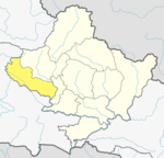
'''Kushmisera''' is a [[village development committee]] in [[Baglung District]] in the [[Dhawalagiri Zone|Dhaulagiri Zone]] of central [[Nepal]]. At the time of the [[1991 Nepal census]] it had a population of 2,944 and had 570 houses in the town.it is divided in to nine different ward number. It includes different villages like Jaiminighat (जैमिनिघाट)(www.facebook.com/jaiminighat) . jaiminighat is the most popular village in kushmisera. which lies near the kaligandaki river. In kushmisera, there are many village which are naturally fullfilled like jaiminighat. |
'''Kushmisera''' is a [[village development committee]] in [[Baglung District]] in the [[Dhawalagiri Zone|Dhaulagiri Zone]] of central [[Nepal]]. At the time of the [[1991 Nepal census]] it had a population of 2,944 and had 570 houses in the town.it is divided in to nine different ward number. It includes different villages like Jaiminighat (जैमिनिघाट)(www.facebook.com/jaiminighat) . jaiminighat is the most popular village in kushmisera. which lies near the kaligandaki river. In kushmisera, there are many village which are naturally fullfilled like jaiminighat. |
||
[written by "Bhuban Chapagain" kushmisera ward no 1jaiminighat Baglung (www.facebook.com/bhuban.chapagain.7) (www.twitter.com/bhubanchapagin)] <ref>{{Cite web| |
[written by "Bhuban Chapagain" kushmisera ward no 1jaiminighat Baglung (www.facebook.com/bhuban.chapagain.7) (www.twitter.com/bhubanchapagin)] <ref>{{Cite web| www.bc.com/collections/nepalcensus/form.php?selection=1|title=Nepal Census 2001|work=Nepal's Village Development Committees|publisher=[[Digital Himalaya]]|accessdate=2008-08-23}}Bhuban Chapagain |
||
==References== |
==References== |
||
Revision as of 13:42, 16 August 2015
|official_name kushmi sera = Kushmisera
|other_name =jaiminighat
|native_name = कुश्मीशेरा
|nickname sera =
|settlement_type = Village development committee
motherland is greater than heaven =
|image_skyline = KushmiSera Bazaar
|image_caption =
|image_flag =
|image_seal =
|image_map =
|mapsize =
|map_caption =
|pushpin_map = Nepal
|pushpin_label_position = bottom
|pushpin_mapsize = 300
|pushpin_map_caption = Location in Nepal
|subdivision_type = Country
|subdivision_name = ![]() Nepal
|subdivision_type1 = Zone
|subdivision_name1 = Dhaulagiri Zone
|subdivision_type2 = District
|subdivision_name2 = Baglung District
|government_footnotes =
|government_type =
|leader_title =
|leader_name =
|leader_title1 =
|leader_name1 =
|established_title =
|established_date =
|unit_pref =
|area_footnotes =
|area_total_km2 =
|area_total_sq_mi =
|population_as_of = 1991
|population_footnotes =
|population_note =
|population_total = 2944
|population_density_km2 = auto
|population_blank1_title = Ethnicities
|population_blank2_title = Religions
|population_blank2 =Hindu
|timezone = Nepal Time
|utc_offset = +5:45
|timezone_DST =
|utc_offset_DST =
|latd= 28.20
|longd= 83.62
|coordinates_display = title
|coordinates_type = type:adm2nd_region:NP_source:unmaps-enwiki
|elevation_footnotes =
|elevation_m =
|postal_code_type =
|postal_code =
|area_code =
|blank_name =
|blank_info =
|website www.ks.com
|footnotes =
}}
Kushmisera is a village development committee in Baglung District in the Dhaulagiri Zone of central Nepal. At the time of the 1991 Nepal census it had a population of 2,944 and had 570 houses in the town.it is divided in to nine different ward number. It includes different villages like Jaiminighat (जैमिनिघाट)(www.facebook.com/jaiminighat) . jaiminighat is the most popular village in kushmisera. which lies near the kaligandaki river. In kushmisera, there are many village which are naturally fullfilled like jaiminighat.
Nepal
|subdivision_type1 = Zone
|subdivision_name1 = Dhaulagiri Zone
|subdivision_type2 = District
|subdivision_name2 = Baglung District
|government_footnotes =
|government_type =
|leader_title =
|leader_name =
|leader_title1 =
|leader_name1 =
|established_title =
|established_date =
|unit_pref =
|area_footnotes =
|area_total_km2 =
|area_total_sq_mi =
|population_as_of = 1991
|population_footnotes =
|population_note =
|population_total = 2944
|population_density_km2 = auto
|population_blank1_title = Ethnicities
|population_blank2_title = Religions
|population_blank2 =Hindu
|timezone = Nepal Time
|utc_offset = +5:45
|timezone_DST =
|utc_offset_DST =
|latd= 28.20
|longd= 83.62
|coordinates_display = title
|coordinates_type = type:adm2nd_region:NP_source:unmaps-enwiki
|elevation_footnotes =
|elevation_m =
|postal_code_type =
|postal_code =
|area_code =
|blank_name =
|blank_info =
|website www.ks.com
|footnotes =
}}
Kushmisera is a village development committee in Baglung District in the Dhaulagiri Zone of central Nepal. At the time of the 1991 Nepal census it had a population of 2,944 and had 570 houses in the town.it is divided in to nine different ward number. It includes different villages like Jaiminighat (जैमिनिघाट)(www.facebook.com/jaiminighat) . jaiminighat is the most popular village in kushmisera. which lies near the kaligandaki river. In kushmisera, there are many village which are naturally fullfilled like jaiminighat.
[written by "Bhuban Chapagain" kushmisera ward no 1jaiminighat Baglung (www.facebook.com/bhuban.chapagain.7) (www.twitter.com/bhubanchapagin)] <ref>"Nepal Census 2001". Nepal's Village Development Committees. Digital Himalaya.{{cite web}}:|access-date=requires|url=(help); Missing or empty|url=(help); Unknown parameter|www.bc.com/collections/nepalcensus/form.php?selection=ignored (help)Bhuban Chapagain
References

