Beaumont, Quebec: Difference between revisions
Appearance
Content deleted Content added
m →References: Remove stub template(s). Page is start class or higher. Also check for and do General Fixes + Checkwiki fixes using AWB |
No edit summary |
||
| Line 51: | Line 51: | ||
|leader_name = André Goulet |
|leader_name = André Goulet |
||
|leader_title1 = [[List of Canadian federal electoral districts|Federal riding]] |
|leader_title1 = [[List of Canadian federal electoral districts|Federal riding]] |
||
|leader_name1 = [[ |
|leader_name1 = [[Bellechasse—Les Etchemins—Lévis]] |
||
|leader_title2 = [[List of Quebec provincial electoral districts|Prov. riding]] |
|leader_title2 = [[List of Quebec provincial electoral districts|Prov. riding]] |
||
|leader_name2 = [[Bellechasse (provincial electoral district)|Bellechasse]] |
|leader_name2 = [[Bellechasse (provincial electoral district)|Bellechasse]] |
||
Revision as of 15:58, 4 December 2015
Beaumont | |
|---|---|
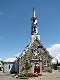
 Saint Etienne Church | |
 Location within Bellechasse RCM. | |
| Country | |
| Province | |
| Region | Chaudière-Appalaches |
| RCM | Bellechasse |
| Constituted | July 1, 1855 |
| Government | |
| • Mayor | André Goulet |
| • Federal riding | Bellechasse—Les Etchemins—Lévis |
| • Prov. riding | Bellechasse |
| Area | |
• Total | 44.70 km2 (17.26 sq mi) |
| • Land | 43.84 km2 (16.93 sq mi) |
| Population (2011)[2] | |
• Total | 2,420 |
| • Density | 55.2/km2 (143/sq mi) |
| • Pop 2006-2011 | |
| • Dwellings | 1,146 |
| Time zone | UTC−5 (EST) |
| • Summer (DST) | UTC−4 (EDT) |
| Postal code(s) | |
| Area code(s) | 418 and 581 |
| Highways | |
| Website | www.municipalite debeaumont.com |
Beaumont is a municipality of about 2,400 people 10 km east of Lévis, next to the Saint Lawrence River, in the Bellechasse Regional County Municipality in the Chaudière-Appalaches region of Quebec. It is a mostly rural community, with most people working in Lévis as there are no major businesses in Beaumont. It was chosen as one of the top 20 nicest villages in the province of Quebec.
It is crossed by Route 132, with many of its shops and commodities built alongside it. A few small streets are attached to the road, but the rest of the municipality is divided using the seigneurial system. The many open fields in Beaumont stretch all the way to the Saint Lawrence river, giving the visitors a large panorama.
References
- ^ a b "Répertoire des municipalités: Geographic code 19105". www.mamh.gouv.qc.ca (in French). Ministère des Affaires municipales et de l'Habitation.
- ^ a b "Beaumont, Quebec (Code 2419105) Census Profile". 2011 census. Government of Canada - Statistics Canada.
- ^ "Banque de noms de lieux du Québec: Reference number 344511". toponymie.gouv.qc.ca (in French). Commission de toponymie du Québec.
