Stanmore Bay: Difference between revisions
Appearance
Content deleted Content added
m en-NZ |
→External links: added link to photographs of Stanmore Bay |
||
| Line 45: | Line 45: | ||
* [http://www.wgpcollege.school.nz/index.html Whangaparaoa College website] |
* [http://www.wgpcollege.school.nz/index.html Whangaparaoa College website] |
||
* [http://www.stanmore.school.nz/ Stanmore Bay School website] |
* [http://www.stanmore.school.nz/ Stanmore Bay School website] |
||
* [http://www.aucklandcity.govt.nz/dbtw-wpd/exec/dbtwpub.dll?AC=SEE_ALSO&QF0=Subjects&QI0==%22Stanmore+Bay%22&XC=/dbtw-wpd/exec/dbtwpub.dll&BU=http%3A%2F%2Fwww.aucklandcity.govt.nz%2Fdbtw-wpd%2Fheritageimages%2Findex.htm&TN=heritageimages&SN=AUTO25398&SE=46&RN=0&MR=20&TR=0&TX=1000&ES=0&CS=1&XP=&RF=HIOReport&EF=&DF=HIORecord&RL=0&EL=0&DL=0&NP=2&ID=&MF=WPEngMsg.ini&MQ=&TI=0&DT=&ST=0&IR=221315&NR=1&NB=0&SV=0&SS=1&BG=&FG=&QS=index&OEX=ISO-8859-1&OEH=ISO-8859-1 Photographs of Stanmore Bay] held in [[Auckland Libraries|Auckland Libraries']] heritage collections. |
|||
{{coord|36|38|S|174|44|E|display=title|region:NZ_type:city_source:GNS-enwiki}} |
{{coord|36|38|S|174|44|E|display=title|region:NZ_type:city_source:GNS-enwiki}} |
||
Revision as of 21:54, 5 February 2016
Stanmore Bay | |
|---|---|
 | |
| Country | New Zealand |
| City | Rodney District |
| Population (2006) | |
• Total | 5,007 |
| (Whangaparaoa Bay) | ||
|
|
Manly | |
| (Weiti River) | Wade Heads |


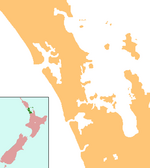
Stanmore Bay is a suburb and beach on the Whangaparaoa Peninsula, in the Auckland Region of New Zealand. The beach is on the northern side of the peninsula.[1]
The population was 5,007 in the 2006 Census, an increase of 405 from 2001.[2]
Education
Whangaparaoa College is a secondary (years 7-13) school with a decile rating of 9[3] and a roll of 1803[4] (August 2024). The college opened at the beginning of 2005, incorporating Hibiscus Coast Intermediate School.[5] It was initially called Stanmore Bay Secondary School.[6]
Stanmore Bay School is a contributing primary (years 1-6) school with a decile rating of 8[7] and a roll of 553[4] (August 2024). The school celebrated its 25th Jubilee in 2004.[8]
Both schools are coeducational.
Notes
- ^ Peter Dowling (editor) (2004). Reed New Zealand Atlas. Reed Books. pp. map 11. ISBN 0-7900-0952-8.
{{cite book}}:|author=has generic name (help) - ^ The population is the sum of the statistical areas of Stanmore Bay West (Quickstats about Stanmore Bay West) and Stanmore Bay East (Quickstats about Stanmore Bay East)
- ^ Education Counts: Whangaparaoa College
- ^ a b "New Zealand Schools Directory". New Zealand Ministry of Education. Retrieved 17 September 2024.
- ^ "Education Review Report - Whangaparaoa College". Education Review Office. July 2007. Retrieved 27 August 2008. [dead link]
- ^ "Mergers, Closures and New Schools, January 2005 - December 2005" (XLS). Education Counts.
- ^ Education Counts: Stanmore Bay School
- ^ "Stanmore Bay School 25th Jubilee Celebration". Education Gazette New Zealand. 83 (8). 10 May 2004.
External links
- Whangaparaoa College website
- Stanmore Bay School website
- Photographs of Stanmore Bay held in Auckland Libraries' heritage collections.

