Ixtlahuacán del Río: Difference between revisions
Appearance
Content deleted Content added
m →Pre-Hispanic antecedents of Ixtlahuacán del Río: WP:CHECKWIKI error fixes / special characters in sortkey fixed using AWB (9427) |
Sr. Alvaro (talk | contribs) I add a new map of a Jalisco' municipality |
||
| Line 21: | Line 21: | ||
|blank_emblem_type = |
|blank_emblem_type = |
||
|blank_emblem_size = |
|blank_emblem_size = |
||
|image_map = |
|image_map = File:Ixtlahuacán del Río.png|thumb |
||
|mapsize = 200px |
|mapsize = 200px |
||
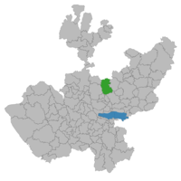
|map_caption = Location of the municipality in Jalisco |
|map_caption = Location of the municipality in Jalisco |
||
Revision as of 00:40, 19 February 2016
Ixtlahuacán del Río | |
|---|---|
Municipality and city | |
 Location of the municipality in Jalisco | |
| Country | |
| State | Jalisco |
| Area | |
• Total | 594.94 km2 (229.71 sq mi) |
| Population (2005) | |
• Total | 18,157 |
Ixtlahuacán del Rio is a town and municipality in the center of the Mexican state of Jalisco, a little less than 50 kilometers from state capital Guadalajara. It stands at 1,655 meters above sea level; the climate is semi-arid, with a mild winter and an average annual temperature of 19 degrees Celsius (66 degrees Fahrenheit).
Pre-Hispanic antecedents of Ixtlahuacán del Río
Ixtlahuacán is a word of Nahuatl origin; the name means "flat place". It was founded by Toltecs approximately 610; it is hard to be certain of the exact date of founding, because none of the groups who inhabited the region — Tecuexes, Tepehuanes, Coanes, Cazcanos, and Zacatecos — had a written language in this period.

