Kolokuma/Opokuma: Difference between revisions
Appearance
Content deleted Content added
No edit summary |
Reverted 1 good faith edit by Sami okpolagha using STiki Questions? Ask at Zppix |
||
| Line 44: | Line 44: | ||
|population_footnotes = |
|population_footnotes = |
||
|population_note = |
|population_note = |
||
|population_total = |
|population_total = 77,292 |
||
|population_density_km2 = |
|population_density_km2 = |
||
|population_density_urban_sq_mi = |
|population_density_urban_sq_mi = |
||
| Line 73: | Line 73: | ||
|footnotes = |
|footnotes = |
||
}} |
}} |
||
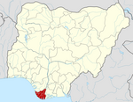
'''Kolokuma/Opokuma''' is a [[Local Government Areas of Nigeria|Local Government Area]] of [[Bayelsa State]], Nigeria. Its headquarters are in the town of Kaiama. Much of the area of the LGA is occupied by the [[Bayelsa National Forest]]. |
'''Kolokuma/Opokuma''' is a [[Local Government Areas of Nigeria|Local Government Area]] of [[Bayelsa State]], Nigeria. Its headquarters are in the town of Kaiama. Much of the area of the LGA is occupied by the [[Bayelsa National Forest]]. |
||
Opu-Okun being the elder son to their father decided to remain in their original settlement in Opokuma clan, while his younger brother (Kala-Okun)was a restless man and he moved his family from one place to another creating other towns, namely: |
|||
1. Igbedi |
|||
2. Kaiama (Ikagi-ama) |
|||
3. Kalama |
|||
4. Odi |
|||
5. Sampou |
|||
6. Okoloba |
|||
7. Seibokorogha (also known as sabagreia) |
|||
8. Olobiri |
|||
9. Ayiba-biri |
|||
It has an area of 361 km² and a population of |
It has an area of 361 km² and a population of 77,292 at the 2006 census. |
||
The [[postal code]] of the area is 560.<ref>{{cite web | title = Post Offices- with map of LGA | work = | publisher = NIPOST | url = http://www.nipost.gov.ng/PostCode.aspx | accessdate = 2009-10-20 | archiveurl=http://web.archive.org/web/20121126042849/http://www.nipost.gov.ng/postcode.aspx | archivedate = 2012-11-26}}</ref> |
The [[postal code]] of the area is 560.<ref>{{cite web | title = Post Offices- with map of LGA | work = | publisher = NIPOST | url = http://www.nipost.gov.ng/PostCode.aspx | accessdate = 2009-10-20 | archiveurl=http://web.archive.org/web/20121126042849/http://www.nipost.gov.ng/postcode.aspx | archivedate = 2012-11-26}}</ref> |
||
Revision as of 23:36, 1 March 2016
Kolokuma/Opokuma | |
|---|---|
LGA and town | |
| Country | |
| State | Bayelsa State |
| Area | |
• Total | 361 km2 (139 sq mi) |
| Population (2006 census) | |
• Total | 77,292 |
| Time zone | UTC+1 (WAT) |
| 3-digit postal code prefix | 560 |
| ISO 3166 code | NG.BY.KO |
Kolokuma/Opokuma is a Local Government Area of Bayelsa State, Nigeria. Its headquarters are in the town of Kaiama. Much of the area of the LGA is occupied by the Bayelsa National Forest.
It has an area of 361 km² and a population of 77,292 at the 2006 census.
The postal code of the area is 560.[1]
References
- ^ "Post Offices- with map of LGA". NIPOST. Archived from the original on 2012-11-26. Retrieved 2009-10-20.

