Vanil de l'Ecri: Difference between revisions
Appearance
Content deleted Content added
added Category:Two-thousanders of Switzerland using HotCat |
remove redundant relief parameter |
||
| Line 8: | Line 8: | ||
| prominence_ref = <ref>Retrieved from the [[Swisstopo]] topographic maps. The key col is the Plan des Eaux (2,236 m).</ref> |
| prominence_ref = <ref>Retrieved from the [[Swisstopo]] topographic maps. The key col is the Plan des Eaux (2,236 m).</ref> |
||
| parent_peak = [[Vanil Noir]] |
| parent_peak = [[Vanil Noir]] |
||
| map = Switzerland |
| map = Switzerland |
||
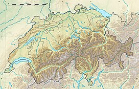
| map_caption = Location in Switzerland |
| map_caption = Location in Switzerland |
||
| listing = |
| listing = |
||
Revision as of 21:09, 9 May 2016
| Vanil de l'Ecri | |
|---|---|
 View from the south with the Vanil Noir (right) | |
| Highest point | |
| Elevation | 2,376 m (7,795 ft) |
| Prominence | 140 m (460 ft)[1] |
| Parent peak | Vanil Noir |
| Geography | |
| Location | Fribourg/Vaud, Switzerland |
| Parent range | Swiss Prealps |
The Vanil de l'Ecri is a mountain of the Swiss Prealps, located on the border between the cantons of Fribourg and Vaud. Reaching a height of 2,376 metres above sea level, it is both the second highest summit of the Vanil Noir massif and the canton of Fribourg. The mountain lies between the Pointe de Paray and the Vanil Noir.
The closest localities are Grandvillard (Fribourg) and Château d'Oex (Vaud).
References
External links

