Capacsaya: Difference between revisions
Appearance
Content deleted Content added
Frank R 1981 (talk | contribs) No edit summary |
Frank R 1981 (talk | contribs) No edit summary |
||
| Line 3: | Line 3: | ||
| photo = |
| photo = |
||
| photo_caption = |
| photo_caption = |
||
| ⚫ | |||
| ⚫ | |||
| elevation_ref = <ref name=ign>{{cite web |url=http://www.ign.gob.pe/nomenclatorDigital/carta.php?id=163353|title=Nevado Capacsaya|author=<!--Staff writer(s); no by-line.--> |date= |website= |publisher=IGN, Peru|accessdate=June 26, 2015}}</ref> |
|||
| ⚫ | |||
| ⚫ | |||
| ⚫ | |||
| ⚫ | |||
| location = [[Peru]], [[Cusco Region]] |
| location = [[Peru]], [[Cusco Region]] |
||
| ⚫ | |||
| ⚫ | |||
| ⚫ | |||
| label_position = |
| label_position = |
||
| lat_d = 13| lat_m = 11| lat_s = 20| lat_NS = S |
| lat_d = 13| lat_m = 11| lat_s = 20| lat_NS = S |
||
| long_d =72| long_m =06| long_s =43| long_EW= W |
| long_d =72| long_m =06| long_s =43| long_EW= W |
||
| ⚫ | |||
| ⚫ | |||
| elevation_ref = |
|||
| ⚫ | |||
| ⚫ | |||
| ⚫ | |||
| ⚫ | |||
| topo = |
| topo = |
||
| ⚫ | |||
| ⚫ | |||
| type = |
| type = |
||
| age = |
| age = |
||
| first_ascent = |
| first_ascent = |
||
| easiest_route = |
| easiest_route = |
||
| ⚫ | |||
}} |
}} |
||
'''Capacsaya,'''<ref name=":0">{{Cite journal|last=Echevarría|first=Evelio|date=1973|title=A Survey of Andean Ascents|url=|journal=American Alpine Journal|volume=18-2|issue=47|page=390|doi=|isbn=9780930410704|pmid=|access-date=}}</ref><ref name=":1">{{Cite book|title=Peru 1:100 000, Urubamba (27-r)|last=|first=|publisher=IGN (Instituto Geográfico Nacional - Perú)|year=|isbn=|location=|pages=}}</ref> '''Ccapacsaya'''<ref name=":2">{{Cite book|url=http://www.rgs.org/NR/rdonlyres/B11E3D06-3E97-45FC-9E82-D394EFA751BD/0/MAPeru.pdf|title=Mountaineering in the Andes|last=Neate|first=Jill|publisher=RGS-IBG Expedition Advisory Centre|year=1994|isbn=0-907649-64-5|location=|pages=55|chapter=Peru|quote=}}</ref> (possibly from [[Quechua language|Quechua]] ''qhapaq'' mighty, ''saya'' slope,<ref>{{Ref Laime}}</ref> "mighty slope"), '''Media Luna'''<ref name=":2" /> or '''Huayurioc'''<ref name=":2" /> is a mountain in the [[ |
'''Capacsaya,'''<ref name=":0">{{Cite journal|last=Echevarría|first=Evelio|date=1973|title=A Survey of Andean Ascents|url=|journal=American Alpine Journal|volume=18-2|issue=47|page=390|doi=|isbn=9780930410704|pmid=|access-date=}}</ref><ref name=":1">{{Cite book|title=Peru 1:100 000, Urubamba (27-r)|last=|first=|publisher=IGN (Instituto Geográfico Nacional - Perú)|year=|isbn=|location=|pages=}}</ref> '''Ccapacsaya'''<ref name=":2">{{Cite book|url=http://www.rgs.org/NR/rdonlyres/B11E3D06-3E97-45FC-9E82-D394EFA751BD/0/MAPeru.pdf|title=Mountaineering in the Andes|last=Neate|first=Jill|publisher=RGS-IBG Expedition Advisory Centre|year=1994|isbn=0-907649-64-5|location=|pages=55|chapter=Peru|quote=}}</ref> (possibly from [[Quechua language|Quechua]] ''qhapaq'' mighty, ''saya'' slope,<ref>{{Ref Laime}}</ref> "mighty slope"), '''Media Luna'''<ref name=":2" /> or '''Huayurioc'''<ref name=":2" /> is a mountain in the [[Urubamba mountain range|Urubamba]] mountain range in the [[Andes]] of [[Peru]], about {{convert|5044|m|ft|0}} high.<ref name=":1" /> It is located in the [[Cusco Region]], [[Calca Province]], [[Lares District]], and in the [[Urubamba Province]], [[Urubamba District]]. Qhapaq Saya lies northwest of [[Ch'iqun]] and east of [[Pumawank'a]], near Pumawank'a Q'asa (Quechua for Pumawank'a pass, hispanicized ''Pumahuancajasa''). |
||
==References== |
==References== |
||
Revision as of 23:42, 14 July 2016
| Qhapaq Saya | |
|---|---|
| Highest point | |
| Elevation | 5,044 m (16,549 ft) |
| Geography | |
| Location | Peru, Cusco Region |
| Parent range | Andes, Urubamba |
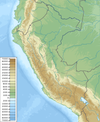
Capacsaya,[1][2] Ccapacsaya[3] (possibly from Quechua qhapaq mighty, saya slope,[4] "mighty slope"), Media Luna[3] or Huayurioc[3] is a mountain in the Urubamba mountain range in the Andes of Peru, about 5,044 metres (16,549 ft) high.[2] It is located in the Cusco Region, Calca Province, Lares District, and in the Urubamba Province, Urubamba District. Qhapaq Saya lies northwest of Ch'iqun and east of Pumawank'a, near Pumawank'a Q'asa (Quechua for Pumawank'a pass, hispanicized Pumahuancajasa).
References
- ^ Echevarría, Evelio (1973). "A Survey of Andean Ascents". American Alpine Journal. 18–2 (47): 390. ISBN 9780930410704.
- ^ a b Peru 1:100 000, Urubamba (27-r). IGN (Instituto Geográfico Nacional - Perú).
- ^ a b c Neate, Jill (1994). "Peru". Mountaineering in the Andes (PDF). RGS-IBG Expedition Advisory Centre. p. 55. ISBN 0-907649-64-5.
- ^ Teofilo Laime Ajacopa (2007). Diccionario Bilingüe: Iskay simipi yuyayk’anch: Quechua – Castellano / Castellano – Quechua (PDF). La Paz, Bolivia: futatraw.ourproject.org.

