La Perouse (New Zealand): Difference between revisions
Declining submission: nn - Submission is about a topic not yet shown to meet general notability guidelines (be more specific if possible) (AFCH 0.9) |
m Robert McClenon moved page Draft:La Perouse to Draft:La Perouse (New Zealand): disambiguate |
(No difference)
| |
Revision as of 00:38, 26 August 2016
This article, La Perouse (New Zealand), has recently been created via the Articles for creation process. Please check to see if the reviewer has accidentally left this template after accepting the draft and take appropriate action as necessary.
Reviewer tools: Inform author |
 Comment: The mountain is almost certainly notable, but references are needed. Robert McClenon (talk) 00:37, 26 August 2016 (UTC)
| La Perouse | |
|---|---|
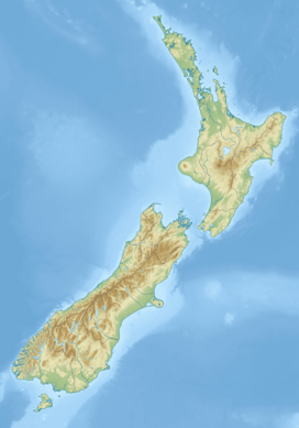
South Island, New Zealand | |
| Highest point | |
| Elevation | 3,078 m (10,098 ft) |
| Prominence | 496 m (1,627 ft) |
| Geography | |
| Location | South Island, New Zealand |
| Parent range | Southern Alps |
| Climbing | |
| Easiest route | glacier/snow/ice climb |
La Perouse (New Zealand) is a mountain in New Zealand's Southern Alps, rising to a height of 3,078 metres (10,098 ft). It is located in the Southern Alps of the South Island, four kilometres to the southwest Aoraki / Mount Cook. Unlike Aoraki / Mount Cook, La Perouse sits on the South Island's Main Divide, on the border between Aoraki/Mount Cook National Park and Westland Tai Poutini National Park. La Perouse was the scene of the most arduous rescue in New Zealand’s climbing history in 1948, where Ruth Adams was injured and had to be carried on a stretcher over the summit and through deep gorges to the West Coast road. She was a member in a climbing party including Harry Ayres, Mick Sullivan and Sir Edmund Hillary.[1]
See also
External Links
http://climbnz.org.nz/nz/si/main-divide-of-the-southern-alps/la-perouse


