Williamstown, Missouri: Difference between revisions
Appearance
Content deleted Content added
m →History: http→https for Google Books and Google News using AWB |
ref |
||
| Line 1: | Line 1: | ||
[[Image:MOMap-doton-Williamstown.png|right]] |
[[Image:MOMap-doton-Williamstown.png|right]] |
||
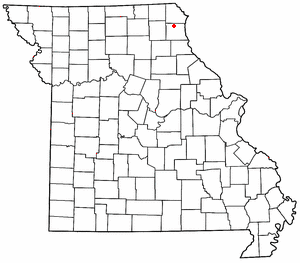
'''Williamstown''' is an [[unincorporated area|unincorporated community]] in northern [[Lewis County, Missouri|Lewis County]], [[Missouri]], [[United States]]. It is located at the intersection of [[Missouri Supplemental Route]]s A and E about twenty miles northwest of [[Canton, Missouri|Canton]]. The community is part of the [[Quincy, Illinois|Quincy]], [[Illinois|IL]]–MO [[Quincy micropolitan area|Micropolitan Statistical Area]]. |
'''Williamstown''' is an [[unincorporated area|unincorporated community]] in northern [[Lewis County, Missouri|Lewis County]], [[Missouri]], [[United States]].<ref>{{GNIS|728908}}</ref> It is located at the intersection of [[Missouri Supplemental Route]]s A and E about twenty miles northwest of [[Canton, Missouri|Canton]]. The community is part of the [[Quincy, Illinois|Quincy]], [[Illinois|IL]]–MO [[Quincy micropolitan area|Micropolitan Statistical Area]]. |
||
==History== |
==History== |
||
Williamstown was laid out in 1856.<ref>{{cite news | url=https://news.google.com/newspapers?id=RN4kAAAAIBAJ&sjid=rRAGAAAAIBAJ&pg=823%2C432150 | title=Williamstown, now 150 years old, was once a busier town | work=Press-News Journal | date=Sep 28, 2006 | accessdate=1 November 2015 | author=Steinbeck, Dan | pages=4}}</ref> The community was named for its founder, Minus Williams.<ref>{{cite book | url=https://books.google.com/books?id=RfAuAAAAYAAJ&pg=PA185#v=onepage&q&f=false | title=How Missouri Counties, Towns and Streams Were Named | publisher=The State Historical Society of Missouri | author=Eaton, David Wolfe | year=1916 | pages=185}}</ref> |
Williamstown was laid out in 1856.<ref>{{cite news | url=https://news.google.com/newspapers?id=RN4kAAAAIBAJ&sjid=rRAGAAAAIBAJ&pg=823%2C432150 | title=Williamstown, now 150 years old, was once a busier town | work=Press-News Journal | date=Sep 28, 2006 | accessdate=1 November 2015 | author=Steinbeck, Dan | pages=4}}</ref> The community was named for its founder, Minus Williams.<ref>{{cite book | url=https://books.google.com/books?id=RfAuAAAAYAAJ&pg=PA185#v=onepage&q&f=false | title=How Missouri Counties, Towns and Streams Were Named | publisher=The State Historical Society of Missouri | author=Eaton, David Wolfe | year=1916 | pages=185}}</ref><ref>{{cite web | url=https://web.archive.org/web/20160624070552/http://shsmo.org/manuscripts/ramsay/ramsay_lewis.html | title=Lewis County Place Names, 1928–1945 (archived)| publisher=The State Historical Society of Missouri| accessdate=26 October 2016}}</ref> |
||
==References== |
==References== |
||
Revision as of 03:15, 28 October 2016

Williamstown is an unincorporated community in northern Lewis County, Missouri, United States.[1] It is located at the intersection of Missouri Supplemental Routes A and E about twenty miles northwest of Canton. The community is part of the Quincy, IL–MO Micropolitan Statistical Area.
History
Williamstown was laid out in 1856.[2] The community was named for its founder, Minus Williams.[3][4]
References
- ^ U.S. Geological Survey Geographic Names Information System: Williamstown, Missouri
- ^ Steinbeck, Dan (Sep 28, 2006). "Williamstown, now 150 years old, was once a busier town". Press-News Journal. p. 4. Retrieved 1 November 2015.
- ^ Eaton, David Wolfe (1916). How Missouri Counties, Towns and Streams Were Named. The State Historical Society of Missouri. p. 185.
- ^ "Lewis County Place Names, 1928–1945 (archived)". The State Historical Society of Missouri. Retrieved 26 October 2016.
40°14′27″N 91°47′50″W / 40.24083°N 91.79722°W

