Lanai Airport: Difference between revisions
Hawaiian |
JJMC89 bot (talk | contribs) Migrate {{Infobox airport}} coordinates parameters to {{Coord}}, see Wikipedia:Coordinates in infoboxes |
||
| Line 13: | Line 13: | ||
| elevation-f = 1,308 |
| elevation-f = 1,308 |
||
| website = [http://hawaii.gov/lny Hawaii.gov/LNY] |
| website = [http://hawaii.gov/lny Hawaii.gov/LNY] |
||
| coordinates = {{coord|20|47|08|N|156|57|05|W|region:US-HI|display=inline,title}} |
|||
| latd = 20 | latm = 47 | lats = 08 | latNS = N |
|||
| longd = 156 | longm = 57 | longs = 05 | longEW = W |
|||
| coordinates_region = US-HI |
|||
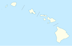
| pushpin_map = USA Hawaii |
| pushpin_map = USA Hawaii |
||
| pushpin_mapsize = 250 |
| pushpin_mapsize = 250 |
||
Revision as of 11:11, 4 December 2016
Lanai Airport Kahua Mokulele o Lāna‘i | |||||||||||
|---|---|---|---|---|---|---|---|---|---|---|---|
| Summary | |||||||||||
| Airport type | Public | ||||||||||
| Owner | Hawaii Department of Transportation | ||||||||||
| Serves | Lanai City, Hawaii | ||||||||||
| Elevation AMSL | 1,308 ft / 399 m | ||||||||||
| Coordinates | 20°47′08″N 156°57′05″W / 20.78556°N 156.95139°W | ||||||||||
| Website | Hawaii.gov/LNY | ||||||||||
| Map | |||||||||||
 | |||||||||||
| Runways | |||||||||||
| |||||||||||
| Statistics (2007) | |||||||||||
| |||||||||||
Lanai Airport[2] (IATA: LNY, ICAO: PHNY, FAA LID: LNY), also written as Lānaʻi Airport, is a state owned, public use airport located three nautical miles (6 km) southwest of the central business district of Lanai City (Lānaʻi City), in Maui County, Hawaii.[1] The airport began regular operations in 1930.[3] It is the only airport serving the island of Lanai (Lānaʻi).
As per Federal Aviation Administration records, the airport had 52,075 passenger boardings (enplanements) in calendar year 2008,[4] 42,594 enplanements in 2009, and 43,922 in 2010.[5] It is included in the National Plan of Integrated Airport Systems for 2011–2015, which categorized it as a primary commercial service airport (more than 10,000 enplanements per year).[6]
Facilities and aircraft
The airport covers an area of 505 acres (204 ha) at an elevation of 1,308 feet (399 m) above mean sea level. It has one runway designated 3/21 with an asphalt surface measuring 5,001 by 150 feet (1,524 x 46 m).[1]
For the 12-month period ending March 16, 2007, the airport had 6,760 aircraft operations, an average of 18 per day: 65% scheduled commercial, 22% air taxi, 12% general aviation, and 2% military.[1]
Airlines and destinations
Passenger
| Airlines | Destinations |
|---|---|
| ʻOhana by Hawaiian operated by Empire Airlines | Honolulu, Molokai |
Accidents and incidents
On February 26, 2014, a charted twin-engine Piper PA-31 Navajo aircraft operated by Maui Air crashed after takeoff from Lanai Airport one mile away. The plane was carrying a pilot and five employees of Maui County. The male pilot and two passengers, both female, were killed, while the other three passengers were injured.[7]
References
- ^ a b c d FAA Airport Form 5010 for LNY PDF. Federal Aviation Administration. Effective April 5, 2012.
- ^ "Lanai Airport". State of Hawaii. Retrieved June 16, 2012.
- ^ "Lanai Airport". Hawaii Aviation. Retrieved January 1, 2015.
- ^ "Enplanements for CY 2008" (PDF, 1.0 MB). faa.gov. Federal Aviation Administration. December 18, 2009.
- ^ "Enplanements for CY 2010" (PDF, 189 KB). faa.gov. Federal Aviation Administration. October 4, 2011.
- ^ "2011–2015 NPIAS Report, Appendix A" (PDF, 2.03 MB). faa.gov. Federal Aviation Administration. October 4, 2010.
- ^ "Small plane crashes on Lanai Island leaving three dead". Hawaii Telegraph. Retrieved February 27, 2014.
{{cite news}}: Italic or bold markup not allowed in:|publisher=(help)
External links
- Lanai Airport
- Hawaii State Department of Transportation
- Topographic map from USGS The National Map
- FAA Terminal Procedures for LNY, effective December 26, 2024
- Resources for this airport:
- FAA airport information for LNY
- AirNav airport information for PHNY
- ASN accident history for LNY
- FlightAware airport information and live flight tracker
- NOAA/NWS latest weather observations for PHNY
- SkyVector aeronautical chart for LNY

