Taiz International Airport: Difference between revisions
Appearance
Content deleted Content added
Fixing infobox not to use deprecated map syntax |
m Turn Taiz in the Infobox into a link |
||
| Line 17: | Line 17: | ||
| operator = N/A |
| operator = N/A |
||
| city-served = |
| city-served = |
||
| location = Taiz |
| location = [[Taiz]] |
||
| elevation-f = 4,838 |
| elevation-f = 4,838 |
||
| elevation-m = 1,475 |
| elevation-m = 1,475 |
||
Revision as of 18:02, 5 January 2017
Taiz International Airport | |||||||||||
|---|---|---|---|---|---|---|---|---|---|---|---|
| Summary | |||||||||||
| Airport type | Public | ||||||||||
| Operator | N/A | ||||||||||
| Location | Taiz | ||||||||||
| Elevation AMSL | 4,838 ft / 1,475 m | ||||||||||
| Coordinates | 13°41′09″N 044°08′21″E / 13.68583°N 44.13917°E | ||||||||||
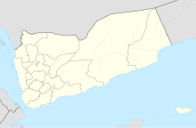
| Map | |||||||||||
 | |||||||||||
| Runways | |||||||||||
| |||||||||||
Taiz International Airport (IATA: TAI, ICAO: OYTZ) is a public airport located in Taiz, the capital of the Taiz Governorate, Yemen.
Airlines and destinations
All flights are currently suspended.[1]
| Airlines | Destinations |
|---|---|
| Felix Airways | Djibouti, Dammam, Hodeida, Jeddah, Sana'a |
| Yemenia | Cairo, Jeddah, Riyadh, Sana'a |
Accidents and incidents
- On 19 March 1969, a Douglas C-47 Skytrain 4W-AAS of Yemen Airlines crashed shortly after take-off due to an incorrectly assembled elevator trim tab which operated in the opposite manner to normal. The aircraft was operating a test flight, all four crew were killed.[2]
- On 13 December 1973, a Douglas DC-3 4W-ABR of Yemen Airlines was reported to have been damaged beyond economic repair.[3]
References
- ^ Ghattas, Abir. "Yemen's No Fly Zone: Thousands of Yemenis are Stranded Abroad". Retrieved 8 April 2015.
- ^ "4W-AAS Accident Description". Aviation Safety Network. Retrieved 9 February 2011.
- ^ "4W-ABR Accident description". Aviation Safety Network. Retrieved 26 August 2010.

