Al-Jdayde: Difference between revisions
built detail infobox |
m correct cat link |
||
| Line 60: | Line 60: | ||
[[Category:Jdeydeh quarter]] |
[[Category:Jdeydeh quarter]] |
||
[[Category:Christian communities in Syria]] |
[[Category:Christian communities in Syria]] |
||
[[Tourist attractions in Syria]] |
[[Category:Tourist attractions in Syria]] |
||
Revision as of 11:38, 10 January 2017
| Al-Jdayde (Aleppo) | |
|---|---|
| Native name جديدة (Arabic) | |
 Al-Jdayde, district of Aleppo as seen in 1920 | |
| Location | Aleppo, Syria |
| Coordinates | 36°12′25.0″N 37°09′24.4″E / 36.206944°N 37.156778°E |
| Built | Late 14th Century |
- For similarly named places, please see Al-Jdayde (disambiguation).
Al-Jdayde (Template:Lang-ar, also transliterated as al-Jdeideh, al-Judayda, al-Jdeïdé or al-Jdeydeh) is a historic neighbourhood in the Syrian city of Aleppo. It is noted for its winding narrow alleys, richly decorated mansions and churches and has become an area of significant cultural and historical interest.
History
At the end of the Mamluk period, al-Jdayde was a small suburb benefiting from a few shops located outside of city’s northern walls and near the cemeteries and storage areas. The development of the city along the roads connecting the Bab al-Nasr gate with neighbouring villages to the North and northeast progressively integrated Jdayde into the city of Aleppo.[1]
By the late 14th century, these quarters were equipped with khutba mosques and fountains made possible by a network of water works. A new water duct, opened in 1490–91, facilitated the further extension of the Jdayde neighbourhood and the creation of its hammams.[2] Christian cemeteries and probably also the remains of ancient churches of the Byzantine period are to be found in the West side of the al-Jdayde suburb. The earlier settlement of Salibeh in this ancient Christian sector, followed by the development of Jdayde, reflects the growth of the Christian population and its desire to reside together in specific areas.[3]
Most churches, newly built or enlarged, are found around a square next to the Salibeh intersection, notably, the Armenian Gregorian Church which was enlarged in 1490,[4] the Greek Orthodox, the Maronite and the Syriac churches. The neighbourhood was gradually settled by notables as well as less affluent residents.[5]
The Armenians, who specialized in trade with Persia and India, were the predominant inhabitants. During the 16th and 17th centuries, following the Ottoman conquest, the neighbourhood was subdivided into rectangular land parcels.[6] Two large Muslim waqfs (religious trusts), founded in 1583-90 and in 1653, have been for centuries the heart of the area. These two architectural ensembles, with richly decorated facades and regular layout, hosted the majority of the commercial and social services for the neighbourhood, where Muslim and Christian, rich and poor, lived side by side. They included a fountain in front of the Christian quarter, a café, a large hammam, a small mosque and a school for Muslim pupils, a cloth market, four large textile workshops,[7] a vast cereal warehouse, and various souks for food and local services.[8]
In 1990–2000, al-Jdayde—noted for its winding narrow alleys, richly decorated mansions and churches—became an area of significant cultural, historical and tourist interest for national and international visitors. Many of the neighbourhood’s historic palaces were transformed into museums, boutique hotels and restaurants. Some of the most important historic buildings of the al-Jdayde quarter include: Beit Wakil, Beit Ghazaleh, Dar Zamaria, Beit Achiqbash[9] Dar Basile and Beit Dallal. The squares of Sahat Farhat and Sahat Al Hatab are found in Jdayde.[10]
Sources and Further Reading
- Abraham, Marcus (1989), "The Middle East on the eve of modernity." New York: Columbia University Press, pp.418.
- David, Jean-Claude (1990), "L'espace des chrétiens à Alep. Ségrégation et mixité, stratégies communautaires (1750-1850)." Revue du monde musulman et de la Méditerranée, 55-56:1-2, pp.150-170.
- Edhem Eldem, Daniel Goffman, and Bruce Masters (1999), "The Ottoman City between East and West: Aleppo, Izmir, and Istanbul." Cambridge: Cambridge University Press, pp. 244.
- Watenpaugh, Heghnar Zeitlian (2004), "The image of an Ottoman city: imperial architecture and urban experience in Aleppo in the 16th and 17th centuries", Leiden: E.J. Brill, pp.278.
Gallery
-
Al-Jdayde circa 1820 was outside Aleppo’s city walls
-
Rooftop view of the Jdeideh district in 2010
-
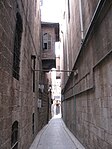
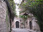
Jdayde alley from Sahat Farhat
-
Windows of "Dar Zamariya" in Jdeidé (postcard 1918-22)
-
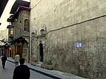
Aleppo Jdeideh Salibeh
-
Beit Ghazaleh is located in the Al-Jdayde district.
-
Jdeyde lane in Aleppo.
-
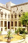
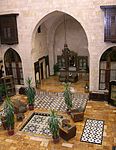
Courtyard of the Ajikbash House
-
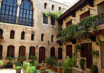
Beit Wakil - Jdeydeh mansion
-
Dar Zamaria hotel in Jdayde
-
Jdeideh alley
-
Old Aleppo arch in Jdeideh
References
- ^ Hazzazé to the north-west, Ramadaniyé to the north-east and Banqousa to the east
- ^ Sauvaget, Jean (1941) Alep, essai sur le développement d’une grande ville syrienne des origines au milieu du XIXe siècle, texte et album, librairie orientaliste Paul Geuthner, Paris : Carte des canalisations mameloukes, p. 182.
- ^ Heghnar Zeitlian Watenpaugh (2004), The image of an Ottoman city: imperial architecture and urban experience in Aleppo in the 16th and 17th centuries, Leiden: EJ Brill, pp. 158-9
- ^ Sauvaget (1941) p. 179.
- ^ Churches and houses shared the same principle of discretion with an absence of facades shown on exterior elevations especially on the main streets. It seems that certain churches may have had their entrances at the end of cul-de-sacs.
- ^ David, Jean-Claude. (1982) « Urbanisation spontanée et planification » Les cahiers de la recherche architecturale, n°10-11.
- ^ The three qaysariya du waqf Ipchir Pacha have been held more than eighty textile operations each with two to four looms thus possibly hosted more than 250 craftsmen at the peak of activities in the area.
- ^ David, Jean-Claude, (2004) « La production de l’espace dans la ville ottomane » Les relations entre musulmans et chrétiens dans le Bilad al-Cham, p. 178–179.
- ^ Transliteration: Beit Ajiqbash, Beit Ajikbash
- ^ Darke, Diana (2010-01-01). Syria. Bradt Travel Guides. ISBN 9781841623146.


