Wierden: Difference between revisions
m Substing templates: {{Ill}}. See User:AnomieBOT/docs/TemplateSubster for info. |
JJMC89 bot (talk | contribs) Migrate {{Infobox settlement}} coordinates parameters to {{Coord}}, see Wikipedia:Coordinates in infoboxes |
||
| Line 18: | Line 18: | ||
| map_alt = Highlighted position of Wierden in a municipal map of Overijssel |
| map_alt = Highlighted position of Wierden in a municipal map of Overijssel |
||
| map_caption = Location in Overijssel |
| map_caption = Location in Overijssel |
||
| coordinates = {{coord|52|21|N|6|36|E|region:NL|display=inline,title}} |
|||
| latd = 52 |latm = 21 |latNS = N |
|||
| longd = 6 |longm = 36 |longEW = E |
|||
| coordinates_display = inline,title |
|||
| coordinates_footnotes = |
| coordinates_footnotes = |
||
| coordinates_region = NL |
|||
<!-- Location, established, seat, subdivisions, government, leaders--> |
|||
| subdivision_type = [[List of sovereign states|Country]] |
| subdivision_type = [[List of sovereign states|Country]] |
||
| subdivision_name = [[Netherlands]] |
| subdivision_name = [[Netherlands]] |
||
Revision as of 09:20, 6 February 2017
Wierden | |
|---|---|
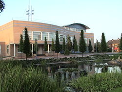
 Wierden city hall | |
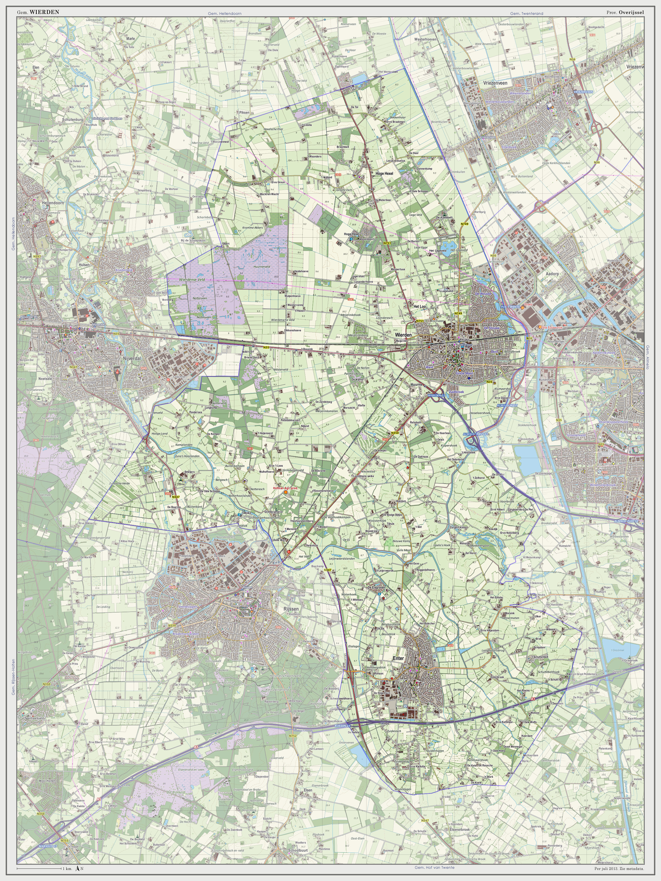
 Location in Overijssel | |
| Coordinates: 52°21′N 6°36′E / 52.350°N 6.600°E | |
| Country | Netherlands |
| Province | Overijssel |
| Government | |
| • Body | Municipal council |
| • Mayor | Henk Robben (CDA) |
| Area | |
• Total | 95.39 km2 (36.83 sq mi) |
| • Land | 94.63 km2 (36.54 sq mi) |
| • Water | 0.76 km2 (0.29 sq mi) |
| Elevation | 11 m (36 ft) |
| Population (January 2021)[4] | |
• Total | 24,538 |
| • Density | 259/km2 (670/sq mi) |
| Demonym | Wierdenaar |
| Time zone | UTC+1 (CET) |
| • Summer (DST) | UTC+2 (CEST) |
| Postcode | 7464–7469, 7640–7649 |
| Area code | 0546, 0547, 0548 |
| Website | www |
 Wierden (ⓘ) is a town and a municipality in the eastern Netherlands, in the province of Overijssel.
The municipality of Wierden also includes the following towns, villages and townships: Enter, Hoge Hexel, IJpelo, Notter, Rectum (Wierden) Zuna.
The municipality has 10 primary schools and 1 secondary school. There are 2 soccer clubs, 2 tennis clubs and 1 volleyball club, this is only the top of the clubs. The village has 3 cemeteries in total of which, only one is currently in use. The major is Henk Robben, who is also the chair of the board of major and aldermen.
In midsummer the locally known, 3-day festival "WieZo" is held. Which starts on a Thursday and ends Saturdays. Every night there are 2 musical acts on the Binnenhof. On Saturday there is also the Wiezoloop.
International relations
Twin towns — sister cities
Wierden is twinned with:
Since September 2010, the town council decided to stop the cooperation between the municipalities because of the high costs and too low benefit.
Gallery
-
World's largest wooden shoe made out of one piece of wood, in the Guinness Book of Records since June 26, 1991. It stands in the village of Enter, Netherlands
-
'Gaanzendriewer' (Geese driver) by Piet Brouwer in front of the Klompenmuseum 't Schöpke
Notable residents
- Berthil ter Avest (1970), soccer player
- Loes Haverkort (1981), actress
- Anton Huiskes (1928–2008), ice-skater and trainer (national team)
- Jos Lammertink (1958), cyclist
- Jan Pouls (1964), soccer player
- Johanna ter Steege (1961), actress
- Eddy Zoëy (1967), radio- and TV presenter and singer
References
- ^ "Wie zit er in het college van b&w?" (in Dutch). Gemeente Wierden. Retrieved 2 April 2014.
{{cite web}}: Unknown parameter|trans_title=ignored (|trans-title=suggested) (help) - ^ "Kerncijfers wijken en buurten 2020" [Key figures for neighbourhoods 2020]. StatLine (in Dutch). CBS. 24 July 2020. Retrieved 19 September 2020.
- ^ "Postcodetool for 7642EB". Actueel Hoogtebestand Nederland (in Dutch). Het Waterschapshuis. Retrieved 2 April 2014.
{{cite web}}: Cite has empty unknown parameter:|trans_title=(help) - ^ "Bevolkingsontwikkeling; regio per maand" [Population growth; regions per month]. CBS Statline (in Dutch). CBS. 1 January 2021. Retrieved 2 January 2022.
External links
 Media related to Wierden at Wikimedia Commons
- Official website


