Mardin Airport: Difference between revisions
Appearance
Content deleted Content added
No edit summary |
Changed '-' to '–' per WP:Airports, Fixed Various Other Name Issues, RegEx Typo Fixing (via JWB) |
||
| Line 48: | Line 48: | ||
==Airlines and destinations== |
==Airlines and destinations== |
||
{{airport-dest-list |
{{airport-dest-list |
||
|[[Pegasus Airlines]]| [[Sabiha Gökçen International Airport| |
|[[Pegasus Airlines]]| [[Sabiha Gökçen International Airport|Istanbul–Sabiha Gökçen]], [[Izmir Airport|İzmir]] |
||
|[[Turkish Airlines]]| [[Istanbul Atatürk Airport| |
|[[Turkish Airlines]]| [[Istanbul Atatürk Airport|Istanbul–Atatürk]] |
||
|[[Turkish Airlines]] <br>{{nowrap|operated by [[AnadoluJet]]}}| [[Esenboğa International Airport|Ankara]], [[Sabiha Gökçen International Airport| |
|[[Turkish Airlines]] <br>{{nowrap|operated by [[AnadoluJet]]}}| [[Esenboğa International Airport|Ankara]], [[Sabiha Gökçen International Airport|Istanbul–Sabiha Gökçen]] |
||
}} |
}} |
||
Revision as of 00:18, 19 February 2017
Mardin Airport Mardin Havaalanı | |||||||||||
|---|---|---|---|---|---|---|---|---|---|---|---|
 | |||||||||||
| Summary | |||||||||||
| Airport type | Public | ||||||||||
| Operator | General Directorate of State Airports Authority | ||||||||||
| Serves | Mardin, Turkey | ||||||||||
| Location | Kızıltepe, Mardin | ||||||||||
| Elevation AMSL | 1,729 ft / 527 m | ||||||||||
| Coordinates | 37°13′58″N 40°38′26″E / 37.23278°N 40.64056°E | ||||||||||
| Website | mardin.dhmi.gov.tr | ||||||||||
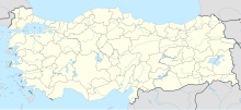
| Map | |||||||||||
 | |||||||||||
| Runways | |||||||||||
| |||||||||||
Mardin Airport is an airport in Mardin, Turkey (IATA: MQM, ICAO: LTCR),[1] located in Kızıltepe, 20 kilometres (12 mi) southeast from Mardin.
Airlines and destinations
| Airlines | Destinations |
|---|---|
| Pegasus Airlines | Istanbul–Sabiha Gökçen, İzmir |
| Turkish Airlines | Istanbul–Atatürk |
| Turkish Airlines operated by AnadoluJet | Ankara, Istanbul–Sabiha Gökçen |
Traffic Statistics
| Year (months) | Domestic | % change | International | % change | Total | % change |
|---|---|---|---|---|---|---|
| 2011 * | 123,971 | 123,971 | ||||
| 2010 | 305,937 | 305,937 | ||||
| 2009 | 233,288 | 233,288 | ||||
| 2008 | 192.764 | 192,764 | ||||
| 2007 | 191,383 | 191,383 |
(*)Source: DHMI.gov.tr[2]
References
37°13′24″N 40°37′54″E / 37.22330°N 40.63170°E

