Simiganj: Difference between revisions
Appearance
Content deleted Content added
add infobox and citations |
JJMC89 bot (talk | contribs) Migrate {{Infobox settlement}} coordinates parameters to {{Coord}}, see Wikipedia:Coordinates in infoboxes |
||
| Line 14: | Line 14: | ||
|pushpin_mapsize =300 |
|pushpin_mapsize =300 |
||
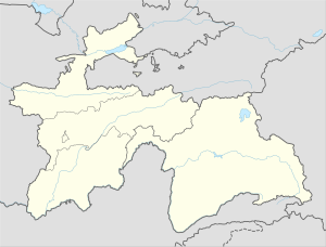
|pushpin_map_caption =Location in Tajikistan |
|pushpin_map_caption =Location in Tajikistan |
||
|coordinates_display = inline,title |
|||
|coordinates_region = TJ |
|||
|subdivision_type = [[Countries of the world|Country]] |
|subdivision_type = [[Countries of the world|Country]] |
||
|subdivision_name = [[File:Flag of Tajikistan.svg|25px]] [[Tajikistan]] |
|subdivision_name = [[File:Flag of Tajikistan.svg|25px]] [[Tajikistan]] |
||
| Line 49: | Line 47: | ||
|timezone_DST = |
|timezone_DST = |
||
|utc_offset_DST = |
|utc_offset_DST = |
||
|coordinates = {{coord|38|39|09|N|069|00|23|E|region:TJ|display=inline,title}} |
|||
|latd=38|latm=39|lats=09|latNS=N |
|||
|longd=069|longm=00|longs=23|longEW=E |
|||
|elevation_footnotes= |
|elevation_footnotes= |
||
|elevation_m = |
|elevation_m = |
||
Revision as of 16:44, 6 March 2017
Simiganj
Simiganch, Simigendzh | |
|---|---|
| Coordinates: 38°39′09″N 069°00′23″E / 38.65250°N 69.00639°E | |
| Country | |
| Province | Districts of Republican Subordination |
| Subregion | East Karotegin |
| District | Vahdat District |
| Time zone | GMT/UTC + 05:00 hour |
Simiganj (or Simiganch) is a town in Vahdat District, Region of Republican Subordination, Tajikistan, in central Asia.[1] The Simiganj River flows through the town. Simiganj Jamoat, which includes rural areas, had a population of 24,249 in 2008.[2]
Notes
- ^ Simiganj (Approved) at GEOnet Names Server, United States National Geospatial-Intelligence Agency
- ^ "List of Jamoats". UN Coordination, Tajikistan. Archived from the original on 26 February 2012.
{{cite web}}: Unknown parameter|deadurl=ignored (|url-status=suggested) (help)

