Jibacoa: Difference between revisions
Appearance
Content deleted Content added
JJMC89 bot (talk | contribs) Migrate {{Infobox settlement}} coordinates parameters to {{Coord}}, see Wikipedia:Coordinates in infoboxes |
|||
| Line 33: | Line 33: | ||
|pushpin_mapsize = 280 |
|pushpin_mapsize = 280 |
||
<!-- Location ------------------> |
<!-- Location ------------------> |
||
|coordinates_display = inline,title |
|||
|coordinates_region = CU |
|||
|subdivision_type = Country |
|subdivision_type = Country |
||
|subdivision_name = {{flag|Cuba}} |
|subdivision_name = {{flag|Cuba}} |
||
| Line 86: | Line 84: | ||
|timezone_DST = |
|timezone_DST = |
||
|utc_offset_DST = |
|utc_offset_DST = |
||
|coordinates = {{coord|23|09|15|N|81|55|02|W|region:CU|display=inline,title}} |
|||
|latd= 23|latm= 09|lats= 15|latNS=N |
|||
|longd= 81|longm= 55|longs=02|longEW=W |
|||
|coord_display = inline, title |
|coord_display = inline, title |
||
|elevation_footnotes = <!--for references: use <ref> </ref> tags--> |
|elevation_footnotes = <!--for references: use <ref> </ref> tags--> |
||
Revision as of 06:01, 8 March 2017
Jibacoa
Playa Jibacoa | |
|---|---|
Village | |
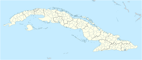
Location of Jibacoa in Cuba | |
| Coordinates: 23°09′15″N 81°55′02″W / 23.15417°N 81.91722°W | |
| Country | |
| Province | Mayabeque |
| Municipality | Santa Cruz del Norte |
| Elevation | 5 m (16 ft) |
| Time zone | UTC-5 (EST) |
| Area code | +53-47 |
Jibacoa, or more properly Playa Jibacoa, is a fishing village in the Mayabeque Province of Cuba. It is located in the municipality of Santa Cruz del Norte, at the mouth of the Jibacoa River, 60 km east of Havana.
Overview
The settlement was founded in 1756 on the location of a corral.
In the 1990s, an all-inclusive resort (under the Jamaican Superclub Breezes brand) was built east of the village. This was one of the first openings of Cuban economy to foreign investments.[citation needed]
See also
References
External links

