Bonthapally: Difference between revisions
Appearance
Content deleted Content added
Eustachiusz (talk | contribs) added Category:Cities and towns in Telangana using HotCat |
JJMC89 bot (talk | contribs) Migrate {{Infobox settlement}} coordinates parameters to {{Coord}}, see Wikipedia:Coordinates in infoboxes |
||
| Line 13: | Line 13: | ||
| pushpin_map_alt = |
| pushpin_map_alt = |
||
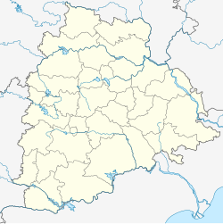
| pushpin_map_caption = Location in Telangana, India |
| pushpin_map_caption = Location in Telangana, India |
||
| |
| coordinates = {{coord|17|39|45|N|78|22|0|E|display=inline,title}} |
||
| latm = 39 |
|||
| lats = 45 |
|||
| latNS = N |
|||
| longd = 78 |
|||
| longm = 22 |
|||
| longs = 0 |
|||
| longEW = E |
|||
| coordinates_display = inline,title |
|||
| subdivision_type = Country |
| subdivision_type = Country |
||
| subdivision_name = {{flag|India}} |
| subdivision_name = {{flag|India}} |
||
Revision as of 22:34, 13 March 2017
Bonthapally | |
|---|---|
| Coordinates: 17°39′45″N 78°22′0″E / 17.66250°N 78.36667°E | |
| Country | |
| State | Telangana |
| District | Sangareddy |
| Area | |
• Total | 9.30 km2 (3.59 sq mi) |
| Population (2011)[1] | |
• Total | 6,608 |
| • Density | 710/km2 (1,800/sq mi) |
| Languages | |
| • Official | Telugu |
| Time zone | UTC+5:30 (IST) |
| Vehicle registration | TS 15 |
| Website | telangana |
Bonthapally is a census town in Sangareddy district of the Indian state of Telangana.[1]
Geography
It is located at 17°39′45″N 78°22′0″E / 17.66250°N 78.36667°E.
References
- ^ a b c "District Census Handbook – Karimnagar" (PDF). Census of India. pp. 12, 44. Retrieved 11 June 2016.


