Urva, Azerbaijan: Difference between revisions
Appearance
Content deleted Content added
JonRichfield (talk | contribs) Added hatnote for the animal |
JJMC89 bot (talk | contribs) Migrate {{Infobox settlement}} coordinates parameters to {{Coord}}, see Wikipedia:Coordinates in infoboxes |
||
| Line 6: | Line 6: | ||
|pushpin_map =Azerbaijan |
|pushpin_map =Azerbaijan |
||
|pushpin_mapsize =300 |
|pushpin_mapsize =300 |
||
|coordinates_region = AZ |
|||
|subdivision_type = Country |
|subdivision_type = Country |
||
|subdivision_name = {{flag|Azerbaijan}} |
|subdivision_name = {{flag|Azerbaijan}} |
||
| Line 25: | Line 24: | ||
|timezone_DST =[[Azerbaijan Time|AZT]] |
|timezone_DST =[[Azerbaijan Time|AZT]] |
||
|utc_offset_DST = +5 |
|utc_offset_DST = +5 |
||
|coordinates = {{coord|41|24|00|N|48|20|12|E|region:AZ|display=inline,title}} |
|||
|latd=41 |latm=24 |lats=00 |latNS=N |
|||
|longd=48|longm=20 |longs=12 |longEW=E |
|||
|coordinates_display = inline,title |
|||
|elevation_m = |
|elevation_m = |
||
|area_code = |
|area_code = |
||
Revision as of 05:38, 23 March 2017
Urva
| |
|---|---|
Municipality | |
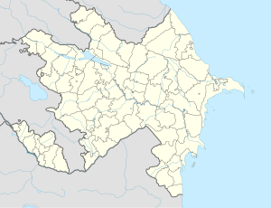
| Coordinates: 41°24′00″N 48°20′12″E / 41.40000°N 48.33667°E | |
| Country | |
| Rayon | Qusar |
| Population | |
• Total | 2,472 |
| Time zone | UTC+4 (AZT) |
| • Summer (DST) | UTC+5 (AZT) |
Urva (also, Urvan) is a village and municipality in the Qusar Rayon of Azerbaijan. It has a population of 2,472. The municipality consists of the villages of Urva and Urvaoba.[1]
References
- ^ "Belediyye Informasiya Sistemi" (in Azerbaijani). Archived from the original on September 24, 2008.


