Kovačji Grad: Difference between revisions
Appearance
Content deleted Content added
GreenC bot (talk | contribs) m 1 archive template merged to {{webarchive}} (WAM) |
JJMC89 bot (talk | contribs) Migrate {{Infobox settlement}} coordinates parameters to {{Coord}}, see Wikipedia:Coordinates in infoboxes |
||
| Line 31: | Line 31: | ||
|pushpin_label_position = right |
|pushpin_label_position = right |
||
|pushpin_map_caption = Location in Slovenia |
|pushpin_map_caption = Location in Slovenia |
||
|coordinates_display = inline,title |
|||
|coordinates_region = SI |
|||
|subdivision_type = Country |
|subdivision_type = Country |
||
|subdivision_name = [[Image:Flag of Slovenia.svg|25px]] [[Slovenia]] |
|subdivision_name = [[Image:Flag of Slovenia.svg|25px]] [[Slovenia]] |
||
| Line 97: | Line 95: | ||
|timezone_DST = |
|timezone_DST = |
||
|utc_offset_DST = |
|utc_offset_DST = |
||
|coordinates = {{coord|45|26|12.63|N|15|13|36.66|E|region:SI|display=inline,title}} |
|||
|latd=45 |latm=26 |lats=12.63 |latNS=N |
|||
|longd=15 |longm=13 |longs=36.66 |longEW=E |
|||
|elevation_footnotes = |
|elevation_footnotes = |
||
|elevation_m = 193.5 |
|elevation_m = 193.5 |
||
Revision as of 10:34, 23 March 2017
Kovačji Grad | |
|---|---|
| Coordinates: 45°26′12.63″N 15°13′36.66″E / 45.4368417°N 15.2268500°E | |
| Country | |
| Traditional region | White Carniola |
| Statistical region | Southeast Slovenia |
| Municipality | Črnomelj |
| Area | |
• Total | 2.84 km2 (1.10 sq mi) |
| Elevation | 193.5 m (634.8 ft) |
| Population (2002) | |
• Total | 15 |
| [1] | |
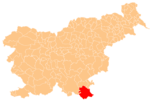
Kovačji Grad (pronounced [kɔˈʋaːtʃji ˈɡɾaːt]) is a small settlement on the left bank of the Kolpa River south of Vinica in the Municipality of Črnomelj in the White Carniola area of southeastern Slovenia. The area is part of the traditional region of Lower Carniola and is now included in the Southeast Slovenia Statistical Region.[2]
References
- ^ Statistical Office of the Republic of Slovenia Archived November 18, 2008, at the Wayback Machine
- ^ Črnomelj municipal site
External links


