Murata (San Marino): Difference between revisions
Appearance
Content deleted Content added
A detail |
JJMC89 bot (talk | contribs) Migrate {{Infobox settlement}} coordinates parameters to {{Coord}}, see Wikipedia:Coordinates in infoboxes |
||
| Line 18: | Line 18: | ||
| area_footnotes = |
| area_footnotes = |
||
| population_density_km2 = auto |
| population_density_km2 = auto |
||
| coordinates = {{coord|43|55|12.12|N|12|27|3.72|E|region:SM|display=inline}} |
|||
| latd = 43 | latm = 55 | lats = 12.12 | latNS = N |
|||
| longd = 12 | longm = 27 | longs = 3.72 | longEW = E |
|||
| coordinates_region = SM |
|||
| coordinates display = inline,title |
| coordinates display = inline,title |
||
| elevation_m = 500 |
| elevation_m = 500 |
||
Revision as of 17:53, 26 March 2017
Murata | |
|---|---|
Village | |
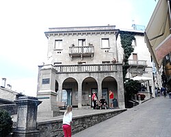 Piazza Giuseppe Garibaldi | |
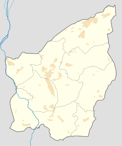
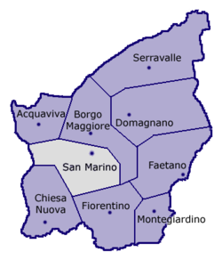 Location of San Marino Municipality within San Marino | |
| Coordinates: 43°55′12.12″N 12°27′3.72″E / 43.9200333°N 12.4510333°E | |
| Country | |
| Municipality | |
| Elevation | 500 m (1,600 ft) |
| Demonym | muratesi |
| Time zone | UTC+1 (CET) |
| • Summer (DST) | UTC+2 (CEST) |
| Postal code | 47890 |
| Area code | +378 (0549) |
| Climate | Cfb |
Murata is a village (curazia) in the middle of San Marino. It belongs to the municipality of San Marino and is its most populated curazia.
Geography
The village is situated on the hills between the City of San Marino and Fiorentino. It has a quarter named Fonte dell'Ovo, seat of the sport plants of Murata.
Sport
The local football team is the Murata.
Photogallery
-
Statue of Liberty in the square of the Town Hall
-
Palazzo Pubblico,
the Town Hall -
Via Paul III
-
Piazza Giuseppe Garibaldi
-
Panoramic view from the walls
See also

