Lake Kuhurlui: Difference between revisions
Appearance
Content deleted Content added
m copyedit, already indirectly in category, refine cat, and AWB general fixes using AWB |
m cleanup (wikitables, html markup, layout, etc.) |
||
| Line 1: | Line 1: | ||
{{unreferenced|date=March 2015}} |
{{unreferenced|date=March 2015}} |
||
{{Infobox lake |
{{Infobox lake |
||
| name = Kuhurluy |
|||
| image =Lake Kuhurluy.jpg |
|||
| caption = |
|||
| image_bathymetry = |
|||
| caption_bathymetry = |
|||
| location = [[Odessa Oblast]] |
|||
| coords = {{coord|45|18|N|28|40|E|type:waterbody_region:UA|display=inline,title}} |
|||
| type = |
|||
| inflow = |
|||
| outflow = |
|||
| catchment = |
|||
| basin_countries = Ukraine |
|||
| length = |
|||
| width = |
|||
| area = {{convert|82|km2|sqmi|abbr=on}} |
|||
| depth = {{convert|0.8|m|ft|abbr=on}} |
|||
| max-depth = {{convert|5|m|ft|abbr=on}} |
|||
| volume = |
|||
| residence_time = |
|||
| shore = |
|||
| elevation = |
|||
| frozen = |
|||
| islands = |
|||
| cities = |
|||
}} |
}} |
||
Revision as of 16:20, 12 April 2017
| Kuhurluy | |
|---|---|
 | |
| Location | Odessa Oblast |
| Coordinates | 45°18′N 28°40′E / 45.300°N 28.667°E |
| Basin countries | Ukraine |
| Surface area | 82 km2 (32 sq mi) |
| Average depth | 0.8 m (2.6 ft) |
| Max. depth | 5 m (16 ft) |
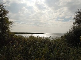
Kuhurluy (Template:Lang-uk) is a lake in the south-western Ukraine, in the south of Bessarabia. It is in complex of the Danube river delta.
Wikimedia Commons has media related to Lake Kuhurlui.
