Piz Malmurainza: Difference between revisions
Appearance
Content deleted Content added
Volcanoguy (talk | contribs) m fixing region parameter to prep for merging range template using AWB |
JJMC89 bot (talk | contribs) Migrate {{Infobox mountain}} coordinates parameters to {{Coord}}, see Wikipedia:Coordinates in infoboxes |
||
| Line 14: | Line 14: | ||
| map = Switzerland |
| map = Switzerland |
||
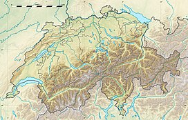
| map_caption = Location in Switzerland |
| map_caption = Location in Switzerland |
||
| coordinates = {{coord|46|54|22|N|10|24|26|E|type:mountain_region:CH_scale:100000|format=dms|display=inline,title}} |
|||
| lat_d = 46 | lat_m = 54 | lat_s = 22 | lat_NS = N |
|||
| range_coordinates = |
|||
| long_d = 10 | long_m = 24 | long_s = 26 | long_EW = E |
|||
| region_code = CH |
|||
| first_ascent = |
| first_ascent = |
||
| easiest_route = |
| easiest_route = |
||
Revision as of 16:52, 19 April 2017
| Piz Malmurainza | |
|---|---|
| Highest point | |
| Elevation | 3,038 m (9,967 ft) |
| Prominence | 229 m (751 ft)[1] |
| Parent peak | Piz Mundin |
| Coordinates | 46°54′22″N 10°24′26″E / 46.90611°N 10.40722°E |
| Geography | |
| Location | Graubünden, Switzerland |
| Parent range | Samnaun Alps |
Piz Malmurainza (3,038 m) is a mountain of the Swiss Samnaun Alps, located north of Tschlin in the canton of Graubünden. It lies between the Muttler and Piz Mundin, on the range separating the main Inn valley from the Samnaun valley.

