Municipal District of Greenview No. 16: Difference between revisions
Added Economy section with citation |
m Updated the caption for the photo. Main administration building has moved. |
||
| Line 10: | Line 10: | ||
<!-- images and maps -----------> |
<!-- images and maps -----------> |
||
| image_skyline = Greenview municiapl building.JPG |
| image_skyline = Greenview municiapl building.JPG |
||
| image_caption = |
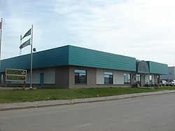
| image_caption = FCSS Building in [[Valleyview, Alberta|Valleyview]] |
||
| image_blank_emblem = AB MD of Greenview logo.png |
| image_blank_emblem = AB MD of Greenview logo.png |
||
| pushpin_map = Alberta municipal districts |
| pushpin_map = Alberta municipal districts |
||
Revision as of 20:21, 13 July 2017
Municipal District of Greenview No. 16 | |
|---|---|
Municipal district | |
 FCSS Building in Valleyview | |
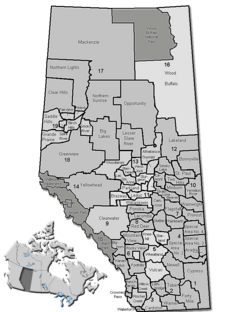
Location of Greenview No. 16 in Alberta | |
| Coordinates: 55°04′7″N 117°16′6″W / 55.06861°N 117.26833°W | |
| Country | |
| Province | |
| Region | Northern Alberta |
| Census division | No. 18 |
| Established | 1994 |
| Government | |
| • Reeve | Dale Gervais |
| • Governing body | M.D. of Greenview Council |
| • Office location | Valleyview |
| Area (2016)[2] | |
| • Land | 32,984.24 km2 (12,735.29 sq mi) |
| Population (2016)[2] | |
• Total | 5,583 |
| • Density | 0.2/km2 (0.5/sq mi) |
| Time zone | UTC-7 (MST) |
| Website | mdgreenview.ab.ca |
The Municipal District of Greenview No. 16 is a municipal district in northwest Alberta, Canada.
It covers the full extent of Census Division 18. Its municipal office is located in the Town of Valleyview.
History
Human settlement of the area now forming Greenview occurred millennia ago with archaeological evidence of native peoples in the Grande Cache area dating back over 10,000 years. [3]
Modern settlement occurred predominately in the early twentieth century throughout the municipal district. Settlers and homesteaders followed various trails to found homesteads and early communities including DeBolt, Ridgevalley, and Grovedale. During the initial influx the Edson to Grande Prairie Trail was a common route for many settlers reaching the north and east sections of Greenview. [4]
In 1968 three improvement districts, formerly 110,111 and 126, were conglomerated to establish Improvement District 16. As an Improvement District it was initially administered under Alberta's Department of Municipal Affairs. In 1996 Improvement District 16 became the Municipal District of Greenview #16 and was fully self-governed. [5]
Demographics
In the 2016 Census of Population conducted by Statistics Canada, the Municipal District of Greenview No. 16 recorded a population of 5,583 living in 2,067 of its 2,473 total private dwellings, a 5.4% change from its 2011 population of 5,299. With a land area of 32,984.24 km2 (12,735.29 sq mi), it had a population density of 0.2/km2 (0.4/sq mi) in 2016.[2]
The Municipal District of Greenview No. 16's 2013 municipal census counted a population of 5,242,[6] a -5% change from its 2000 municipal census population of 5,516.[7]
In the 2011 Census, the Municipal District of Greenview No. 16 had a population of 5,299 living in 1,970 of its 2,197 total dwellings, a -3% change from its 2006 population of 5,464. With a land area of 32,989.05 km2 (12,737.14 sq mi), it had a population density of 0.2/km2 (0.4/sq mi) in 2011.[8]
In 2006, Greenview No. 16 had a population of 5,464 living in 2,064 dwellings, a 0.5% increase from 2001. The municipal district has a land area of 32,994.14 km2 (12,739.11 sq mi) and a population density of 0.2/km2 (0.52/sq mi).[9]
In 2001, the municipal district had a population of 5,439 in 2,002 dwellings, a 0.1% increase from 1996. On a surface of 33,383.92 km² it had a density of 0.2 inhabitants/km².[10]
Economy
Oil and gas is the main economic driver in the Municipal District of Greenview, along with forestry and agriculture. [11]
Communities and localities
|
The following urban municipalities are surrounded by the Municipal District of Greenview No. 16:[12]
The following hamlets are located within the Municipal District of Greenview No. 16:[12] |
The following localities are located within the Municipal District of Greenview No. 16:[13]
|
|
See also
References
- ^ "Municipal Officials Search". Alberta Municipal Affairs. May 9, 2019. Retrieved October 1, 2021.
- ^ a b c "Population and dwelling counts, for Canada, provinces and territories, and census subdivisions (municipalities), 2016 and 2011 censuses – 100% data (Alberta)". Statistics Canada. February 8, 2017. Retrieved February 8, 2017.
- ^ "History". Aseniwuche Winewak Nation of Canada. Retrieved 13 July 2017.
- ^ "Edson Trail and the Long Trail". Heritage of the Mighty Peace. Retrieved 13 July 2017.
- ^ "Municipal District of Greenview History". South Peace Regional Archives. Retrieved 13 July 2017.
- ^ "2013 Census Newsletter" (PDF) (PDF). Municipal District of Greenview No. 16. Retrieved December 5, 2013.
- ^ "2000 Official Population List" (PDF) (PDF). Alberta Municipal Affairs. September 1, 2000. Retrieved December 5, 2013.
- ^ "Population and dwelling counts, for Canada, provinces and territories, and census subdivisions (municipalities), 2011 and 2006 censuses (Alberta)". Statistics Canada. 2012-02-08. Retrieved 2012-02-08.
- ^ Statistics Canada. "Canada 2006 Census: Greenview No. 16 - Community Profile". Retrieved 2007-06-11.
- ^ Greenview community profile - Statistics Canada. 2002. 2001 Community Profiles. Released June 27, 2002. Last modified: 2005-11-30. Statistics Canada Catalogue no. 93F0053XIE
- ^ "Why Valleyview". Town of Valleyview. Retrieved 13 July 2017.
- ^ a b "Specialized and Rural Municipalities and Their Communities" (PDF). Alberta Municipal Affairs. 2012-03-01. Retrieved 2012-08-11.
- ^ "Standard Geographical Classification (SGC) 2006, Economic Regions: 4818015 - Greenview No. 16, geographical codes and localities, 2006". Statistics Canada. 2010-03-05. Retrieved 2012-08-11.
- ^ "Ward 4: Sunset House & Sweathouse" (PDF) (PDF). Municipal District of Greenview No. 16. June 2, 2010. Retrieved June 30, 2014.


