San José de Comayagua: Difference between revisions
Appearance
Content deleted Content added
JJMC89 bot (talk | contribs) Migrate {{Infobox settlement}} coordinates parameters to {{Coord}}, see Wikipedia:Coordinates in infoboxes |
No edit summary |
||
| Line 1: | Line 1: | ||
{{Infobox settlement |
{{Infobox settlement |
||
|official_name = San José Comayagua |
|official_name = San José Comayagua |
||
| ⚫ | |||
|other_name = |
|other_name = |
||
| ⚫ | |||
| ⚫ | |||
| ⚫ | |||
| ⚫ | |||
|image_skyline = |
|image_skyline = |
||
|imagesize = |
|imagesize = |
||
| Line 14: | Line 13: | ||
|image_shield = |
|image_shield = |
||
|shield_size = |
|shield_size = |
||
|image_blank_emblem = |
|image_blank_emblem =Flag of Otradnoe (Leningrad oblast).png{{!}}border |
||
| blank_emblem_type = Symbol |
|||
|blank_emblem_size = |
|blank_emblem_size = |
||
| ⚫ | |||
| ⚫ | |||
|image_map = |
|image_map = |
||
|mapsize = |
|mapsize = |
||
| Line 21: | Line 23: | ||
|pushpin_map = Honduras |
|pushpin_map = Honduras |
||
|pushpin_label_position = |
|pushpin_label_position = |
||
| ⚫ | |||
|subdivision_type = [[Countries of the world|Country]] |
|subdivision_type = [[Countries of the world|Country]] |
||
|subdivision_name = {{HON}} |
|subdivision_name = {{HON}} |
||
|subdivision_type1 = [[Departments of Honduras|Departament]] |
|subdivision_type1 = [[Departments of Honduras|Departament]] |
||
| ⚫ | |||
|subdivision_name1 = [[Comayagua department|Comayagua]] |
|subdivision_name1 = [[Comayagua department|Comayagua]] |
||
| ⚫ | |||
|subdivision_name2 = |
|subdivision_name2 = |
||
|government_type = |
|||
| ⚫ | |||
| ⚫ | |||
| ⚫ | |||
| ⚫ | |||
|established_title = |
|established_title = |
||
|established_date = |
|established_date = |
||
| Line 38: | Line 36: | ||
|established_title3 = |
|established_title3 = |
||
|established_date3 = |
|established_date3 = |
||
| |
|government_type = |
||
| ⚫ | |||
| ⚫ | |||
| ⚫ | |||
| ⚫ | |||
|unit_pref = <!--Enter: Imperial, if Imperial (metric) is desired--> |
|unit_pref = <!--Enter: Imperial, if Imperial (metric) is desired--> |
||
|area_footnotes = |
|area_footnotes = |
||
| ⚫ | |||
|area_total_km2 = 83 |
|area_total_km2 = 83 |
||
| ⚫ | |||
| ⚫ | |||
|area_total_sq_mi = |
|area_total_sq_mi = |
||
| ⚫ | |||
|area_land_sq_mi = |
|area_land_sq_mi = |
||
| ⚫ | |||
|area_water_sq_mi = |
|area_water_sq_mi = |
||
|area_water_percent = |
|area_water_percent = |
||
| Line 52: | Line 55: | ||
|area_metro_km2 = |
|area_metro_km2 = |
||
|area_metro_sq_mi = |
|area_metro_sq_mi = |
||
| ⚫ | |||
| ⚫ | |||
| ⚫ | |||
| ⚫ | |||
|population_as_of = 2015 |
|population_as_of = 2015 |
||
|population_footnotes = |
|population_footnotes = |
||
|population_note = |
|||
| ⚫ | |||
| ⚫ | |||
|population_density_km2 = auto |
|population_density_km2 = auto |
||
|population_density_sq_mi = |
|population_density_sq_mi = |
||
| ⚫ | |||
| ⚫ | |||
|population_metro = |
|population_metro = |
||
|population_density_metro_km2 = |
|population_density_metro_km2 = |
||
|population_density_metro_sq_mi = |
|population_density_metro_sq_mi = |
||
| |
|population_note = |
||
| ⚫ | |||
| ⚫ | |||
| ⚫ | |||
| ⚫ | |||
| ⚫ | |||
| ⚫ | |||
| ⚫ | |||
| ⚫ | |||
| ⚫ | |||
| ⚫ | |||
|postal_code_type = <!-- enter ZIP code, Postcode, Post code, Postal code... --> |
|postal_code_type = <!-- enter ZIP code, Postcode, Post code, Postal code... --> |
||
|postal_code = |
|postal_code = |
||
| Line 78: | Line 74: | ||
|website = |
|website = |
||
|footnotes = |
|footnotes = |
||
| ⚫ | |||
|timezone = |
|||
|utc_offset = |
|||
| ⚫ | |||
| ⚫ | |||
}} |
}} |
||
Revision as of 01:53, 24 July 2017
San José Comayagua | |
|---|---|
Municipality | |
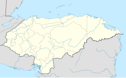
| Coordinates: 14°44′N 88°02′W / 14.733°N 88.033°W | |
| Country | |
| Departament | Comayagua |
| Area | |
• Total | 83 km2 (32 sq mi) |
| Population (2015) | |
• Total | 7,856 |
| • Density | 95/km2 (250/sq mi) |
San José de Comayagua (Spanish pronunciation: [saŋ xoˈse ðe komaˈʝaɣwa]) is a municipality in the Honduran department of Comayagua.


