North University Park, Los Angeles: Difference between revisions
Not in North Los Angeles; changed to South Los Angeles |
→National Register of Historic Places: adding citations |
||
| Line 50: | Line 50: | ||
There are two Historic Districts in North University Park. |
There are two Historic Districts in North University Park. |
||
The [[Menlo Avenue–West Twenty-ninth Street Historic District]] is bounded by West Adams Boulevard on the north, Ellendale on the east, West Thirtieth Street on the south, and Vermont Avenue to the west. The district was added to the National Register of Historic Places in 1987. |
The [[Menlo Avenue–West Twenty-ninth Street Historic District]] is bounded by West Adams Boulevard on the north, Ellendale on the east, West Thirtieth Street on the south, and Vermont Avenue to the west. The district was added to the National Register of Historic Places in 1987.<ref>https://npgallery.nps.gov/AssetDetail/NRIS/87000139</ref> |
||
The [[North University Park Historic District]] is bounded by West Adams Boulevard on the north, Magnolia Avenue on the west, Hoover Street on the east, and 28th Street on the south. The district was added to the National Register of Historic Places in 2004. |
The [[North University Park Historic District]] is bounded by West Adams Boulevard on the north, Magnolia Avenue on the west, Hoover Street on the east, and 28th Street on the south. The district was added to the National Register of Historic Places in 2004.<ref>https://npgallery.nps.gov/AssetDetail/NRIS/04000016</ref> |
||
==References== |
==References== |
||
Revision as of 04:56, 13 September 2017
This article includes a list of general references, but it lacks sufficient corresponding inline citations. (September 2017) |
North University Park | |
|---|---|
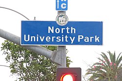
 North University Park signage located at the intersection of Vermont Avenue and Adams Boulevard | |
| Coordinates: 34°1′48″N 118°17′20″W / 34.03000°N 118.28889°W | |
| Country | |
| State | |
| County | |
| Time zone | Pacific |
| Zip Code | 90034 |
| Area code | 323 |
North University Park is a neighborhood in Los Angeles, California. It contains two historic districts that are both on the National Register of Historic Places: The North University Park Historic District and the Menlo Avenue–West Twenty-ninth Street Historic District.[1]
Geography
According to the City of Los Angeles, North University Park is located between Vermont Avenue on the West, Hoover Street on the East, Adams Boulevard on the North and 30th Place on the South.[2]
History
Located just north of USC's campus, North University Park was agricultural land until the late nineteenth century. Today, the neighborhood features one of the richest collections of historic architecture in the city of Los Angeles, including Victorian and Craftsman homes dating back to the 1800s.[1]
National Register of Historic Places
There are two Historic Districts in North University Park.
The Menlo Avenue–West Twenty-ninth Street Historic District is bounded by West Adams Boulevard on the north, Ellendale on the east, West Thirtieth Street on the south, and Vermont Avenue to the west. The district was added to the National Register of Historic Places in 1987.[3]
The North University Park Historic District is bounded by West Adams Boulevard on the north, Magnolia Avenue on the west, Hoover Street on the east, and 28th Street on the south. The district was added to the National Register of Historic Places in 2004.[4]
References
- ^ a b Charles Epting (2 July 2013). University Park, Los Angeles: A Brief History. Arcadia Publishing Incorporated. pp. 67–. ISBN 978-1-62584-028-8.
- ^ https://planning.lacity.org/complan/specplan/pdf/nunipark.pdf
- ^ https://npgallery.nps.gov/AssetDetail/NRIS/87000139
- ^ https://npgallery.nps.gov/AssetDetail/NRIS/04000016

