Fontanile: Difference between revisions
Appearance
Content deleted Content added
JJMC89 bot (talk | contribs) m Repair coordinate parameters error |
Cote d'Azur (talk | contribs) |
||
| Line 129: | Line 129: | ||
[[Category:Cities and towns in Piedmont]] |
[[Category:Cities and towns in Piedmont]] |
||
{{Asti-geo-stub}} |
|||
Revision as of 17:16, 19 October 2017
Fontanile | |
|---|---|
| Comune di Fontanile | |
 | |
| Coordinates: 44°45′N 8°25′E / 44.750°N 8.417°E | |
| Country | Italy |
| Region | Piedmont |
| Province | Province of Asti (AT) |
| Area | |
• Total | 8.0 km2 (3.1 sq mi) |
| Population (Dec. 2004)[2] | |
• Total | 572 |
| • Density | 72/km2 (190/sq mi) |
| Time zone | UTC+1 (CET) |
| • Summer (DST) | UTC+2 (CEST) |
| Postal code | 14044 |
| Dialing code | 0141 |
| Website | Official website |
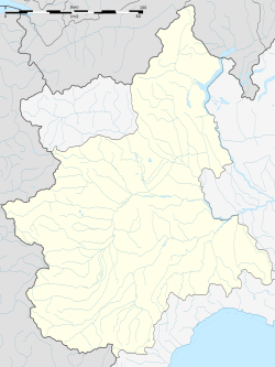
Fontanile is a comune (municipality) in the Province of Asti in the Italian region Piedmont, located about 70 kilometres (43 mi) southeast of Turin and about 25 kilometres (16 mi) southeast of Asti. As of 31 December 2004, it had a population of 572 and an area of 8.0 square kilometres (3.1 sq mi).[3]
Fontanile borders the following municipalities: Alice Bel Colle, Castel Boglione, Castel Rocchero, Castelletto Molina, Mombaruzzo, Nizza Monferrato, and Quaranti.
Demographic evolution

References
- ^ "Superficie di Comuni Province e Regioni italiane al 9 ottobre 2011". Italian National Institute of Statistics. Retrieved 16 March 2019.
- ^ "Popolazione Residente al 1° Gennaio 2018". Italian National Institute of Statistics. Retrieved 16 March 2019.
- ^ All demographics and other statistics: Italian statistical institute Istat.
External links
Wikimedia Commons has media related to Fontanile.


