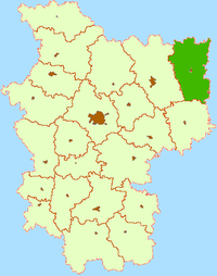
Krupki district: Difference between revisions
Appearance
Content deleted Content added
m Ymblanter moved page Krupki Raion to Krupki District over redirect: in accordance with previously found consensus for Belarusian districts |
No edit summary |
||
| Line 1: | Line 1: | ||
{{Infobox settlement |
{{Infobox settlement |
||
<!-- See Template:Infobox settlement for additional fields and descriptions --> |
|||
|type = [[districts of Belarus|District]] |
|||
|name = Krupki Raion |
|name = Krupki Raion |
||
|other_name = |
|other_name = |
||
| Line 13: | Line 15: | ||
|imagesize = |
|imagesize = |
||
|image_caption = |
|image_caption = |
||
|settlement_type = |
|||
|subdivision_type = |
|subdivision_type = |
||
|subdivision_name = |
|subdivision_name = |
||
Revision as of 19:38, 16 November 2017
Krupki Raion
| |
|---|---|
 | |
| Administrative center | Krupki |
| Area | |
• Total | 2.100 km2 (0.811 sq mi) |
| Population | |
• Total | 28.000 |
| Website | Krupki ispolkom website |
Krupki Raion is a second-level administrative subdivision (raion) of Minsk Voblast, Belarus. Its capital is the town of Krupki.[1]
The largest lake of the district is Lake Selyava (fourteenth the largest in Belarus).[2]
References
- ^ Krupki raion page at Minsk Oblispolkom website
- ^ "Main characteristics of the largest lakes of Belarus". Land of Ancestors. Data of the Research Laboratory for Lake Study of the Belarus State University. 2011. Retrieved 6 September 2013.
54°19′30″N 29°08′10″E / 54.32500°N 29.13611°E


