Muglad: Difference between revisions
Appearance
Content deleted Content added
JJMC89 bot (talk | contribs) Migrate {{Infobox settlement}} coordinates parameters to {{Coord}}, see Wikipedia:Coordinates in infoboxes |
Julia Joerin (talk | contribs) m added a more common way of transliteration from the Arabic مسيرية to English |
||
| Line 122: | Line 122: | ||
|footnotes = |
|footnotes = |
||
}} |
}} |
||
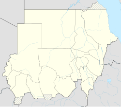
'''Muglad''' is a town in [[West Kurdufan]] State in the south of [[Sudan]]. It is the center town of the Messeria tribe. |
'''Muglad''' is a town in [[West Kurdufan]] State in the south of [[Sudan]]. It is the center town of the Misseriya tribe, sometimes also transliterated as "Messeria" tribe. |
||
== Transport == |
== Transport == |
||
Revision as of 01:54, 9 January 2018
Muglad | |
|---|---|
Town | |
| Coordinates: 11°2′2″N 27°44′24″E / 11.03389°N 27.74000°E | |
| Country | |
| State | West Kurdufan |
Muglad is a town in West Kurdufan State in the south of Sudan. It is the center town of the Misseriya tribe, sometimes also transliterated as "Messeria" tribe.
Transport
It is served by a railway station on the Waw branch of Sudan Railways.
It is the junction for a branch line to the oil fields at Abu Jabra.
See also
References
11°2′2″N 27°44′24″E / 11.03389°N 27.74000°E

