Muglad: Difference between revisions
Appearance
Content deleted Content added
Julia Joerin (talk | contribs) Added a link to another page |
Julia Joerin (talk | contribs) uploaded a photo Tags: Incorrectly formatted external link or image Visual edit |
||
| Line 142: | Line 142: | ||
{{Sudan-geo-stub}}https://commons.wikimedia.org/wiki/File:Muglad_in_front_of_ICRC_office_2011.jpg |
|||
{{Sudan-geo-stub}} |
|||
Revision as of 19:56, 12 January 2018
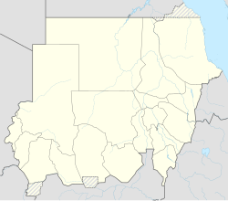
Muglad | |
|---|---|
Town | |
| Coordinates: 11°2′2″N 27°44′24″E / 11.03389°N 27.74000°E | |
| Country | |
| State | West Kurdufan |
Muglad is a town in West Kurdufan State in the south of Sudan. It is the center town of the Misseriya tribe, sometimes also transliterated as "Messeria" tribe.
Transport
It is served by a railway station on the Waw branch of Sudan Railways.
It is the junction for a branch line to the oil fields at Abu Jabra.
See also
References
11°2′2″N 27°44′24″E / 11.03389°N 27.74000°E
https://commons.wikimedia.org/wiki/File:Muglad_in_front_of_ICRC_office_2011.jpg

