Changfeng County: Difference between revisions
Appearance
Content deleted Content added
No edit summary |
|||
| Line 19: | Line 19: | ||
|imagesize = |
|imagesize = |
||
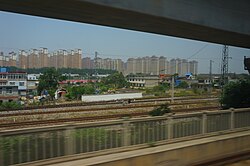
|image_caption = View of Shuangdunji in Changfeng from HSR |
|image_caption = View of Shuangdunji in Changfeng from HSR |
||
|image_flag = |
|image_flag = Spannum vlag.svg |
||
|flag_size = |
|flag_size = |
||
|image_seal = |
|image_seal = |
||
Revision as of 11:57, 22 January 2018
Changfeng County | |
|---|---|
| Chinese transcription(s) | |
| • Chinese | 长丰县 |
| • Pinyin | "Chángfēng Xiàn" |
 View of Shuangdunji in Changfeng from HSR | |
 | |
| Country | China |
| Province | Anhui |
| Prefecture | Hefei |
| Area | |
• Total | 1,922.24 km2 (742.18 sq mi) |
| Population (2010 Census) | |
• Total | 629,535 |
| • Density | 330/km2 (850/sq mi) |
| Time zone | UTC+8 (China Standard) |
| Website | http://www.changfeng.gov.cn/ |
Changfeng County (simplified Chinese: 长丰县; traditional Chinese: 長豐縣; pinyin: Chángfēng Xiàn) is a county in Anhui Province, People's Republic of China, under the administration of Hefei city. The county has a surface of 1,922.24 km² and a population of 629,535 inhabitants.[1] It contains 9 towns, 6 townships, and a development zone.
References
- ^ Template:Zh icon Compilation by LianXin website. Data from the Sixth National Population Census of the People's Republic of China Archived 2012-03-25 at the Wayback Machine
32°11′18″N 117°11′10″E / 32.1883°N 117.186°E

