Nagyigmánd: Difference between revisions
Appearance
Content deleted Content added
JJMC89 bot (talk | contribs) Migrate {{Infobox settlement}} coordinates parameters to {{Coord}}, see Wikipedia:Coordinates in infoboxes |
No edit summary |
||
| Line 1: | Line 1: | ||
{{Infobox settlement <!--more fields are available for this Infobox--See Template:Infobox Settlement--> |
{{Infobox settlement <!--more fields are available for this Infobox--See Template:Infobox Settlement--> |
||
|settlement_type = Large village |
|||
|subdivision_type = [[Countries of the world|Country]] |
|subdivision_type = [[Countries of the world|Country]] |
||
|subdivision_name = {{HUN}} |
|subdivision_name = {{HUN}} |
||
| Line 7: | Line 8: | ||
|utc_offset_DST=+2 |
|utc_offset_DST=+2 |
||
|official_name=Nagyigmánd |
|||
| |
|||
|image_shield=HUN Nagyigmánd Címer.svg |
|||
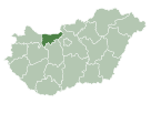
map=[[Image:KEMegye.png|center|thumb|275px|Location of Komárom-Esztergom county in Hungary]] |
|map=[[Image:KEMegye.png|center|thumb|275px|Location of Komárom-Esztergom county in Hungary]] |
||
subdivision_type1=[[Counties of Hungary|County]] |
|subdivision_type1=[[Counties of Hungary|County]] |
||
subdivision_name1=[[Komárom-Esztergom]] |
|subdivision_name1=[[Komárom-Esztergom County|Komárom-Esztergom]] |
||
|subdivision_type2=[[Districts of Hungary|District]] |
|||
| ⚫ | |||
|subdivision_name2=[[Komárom District|Komárom]] |
|||
| ⚫ | |||
| ⚫ | |||
| ⚫ | |||
| ⚫ | |||
| ⚫ | |||
| ⚫ | |||
| ⚫ | |||
| ⚫ | |||
| ⚫ | |||
| ⚫ | |||
| ⚫ | |||
| ⚫ | |||
| ⚫ | |||
|area_code_type=[[Telephone numbers in Hungary|Area code]] |
|||
| ⚫ | |||
| ⚫ | |||
|pushpin_label_position = <!-- the position of the pushpin label: left, right, top, bottom, none --> |
|pushpin_label_position = <!-- the position of the pushpin label: left, right, top, bottom, none --> |
||
|pushpin_map_caption =Location of Nagyigmánd |
|pushpin_map_caption =Location of Nagyigmánd |
||
| Line 25: | Line 29: | ||
|coordinates = {{coord|47.63253|18.05569|region:HU|display=inline,title}} |
|coordinates = {{coord|47.63253|18.05569|region:HU|display=inline,title}} |
||
}} |
}} |
||
'''Nagyigmánd''' is a village in [[Komárom-Esztergom]] county, [[Hungary]]. It is the site of an ancient earthwork fort. |
'''Nagyigmánd''' is a village in [[Komárom-Esztergom]] county, [[Hungary]]. It is the site of an ancient earthwork fort. |
||
[[Image:Nagyigmánd légifotó.jpg|300px|thumb|left|Nagyigmánd, [[Earthworks (archaeology)|earthwork]] [[fort]] from above]] |
[[Image:Nagyigmánd légifotó.jpg|300px|thumb|left|Nagyigmánd, [[Earthworks (archaeology)|earthwork]] [[fort]] from above]] |
||
| Line 33: | Line 36: | ||
==External links== |
==External links== |
||
{{Commons-inline}} |
|||
* {{Official website|http://www.nagyigmand.hu/}} in Hungarian |
|||
* [http://www.terkepcentrum.hu/index.asp?go=map&tid=22372 Street map (Hungarian)] |
* [http://www.terkepcentrum.hu/index.asp?go=map&tid=22372 Street map (Hungarian)] |
||
{{Komárom District}} |
|||
{{Komárom-Esztergom}} |
|||
{{DEFAULTSORT:Nagyigmand}} |
{{DEFAULTSORT:Nagyigmand}} |
||
Revision as of 22:09, 10 February 2018
Nagyigmánd | |
|---|---|
Large village | |
| Coordinates: 47°37′57″N 18°03′20″E / 47.63253°N 18.05569°E | |
| Country | |
| County | Komárom-Esztergom |
| District | Komárom |
| Area | |
• Total | 51.39 km2 (19.84 sq mi) |
| Population (2004) | |
• Total | 3,166 |
| • Density | 61.6/km2 (160/sq mi) |
| Time zone | UTC+1 (CET) |
| • Summer (DST) | UTC+2 (CEST) |
| Postal code | 2942 |
| Area code | (+36) 34 |
Nagyigmánd is a village in Komárom-Esztergom county, Hungary. It is the site of an ancient earthwork fort.

References
External links
![]() Media related to Nagyigmánd at Wikimedia Commons
Media related to Nagyigmánd at Wikimedia Commons
- Official website in Hungarian
- Street map (Hungarian)


