Arrondissement of Saint-Pierre, Martinique: Difference between revisions
Appearance
Content deleted Content added
mNo edit summary |
SkyGazer 512 (talk | contribs) m →top: Replaced "French arrondissement" with "Template:Infobox French arrondissement" - see WP:AutoWikiBrowser/Tasks using AWB |
||
| Line 1: | Line 1: | ||
[[File:Le_Carbet.JPG|thumb|right|Le Carbet, Saint-Pierre]] |
[[File:Le_Carbet.JPG|thumb|right|Le Carbet, Saint-Pierre]] |
||
{{French arrondissement |
{{Infobox French arrondissement |
||
| nomarr=Arrondissement of Saint-Pierre |
| nomarr=Arrondissement of Saint-Pierre |
||
| rég=[[Martinique]] |
| rég=[[Martinique]] |
||
Revision as of 12:34, 4 April 2018

Arrondissement of Saint-Pierre, Martinique | |
|---|---|
Settlement | |
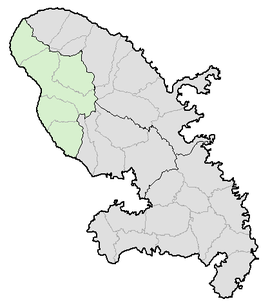
 Location of Saint-Pierre in Martinique | |
| Country | France |
| Population (2013) | 23,402 |
The arrondissement of Saint-Pierre is an arrondissement of France in the Martinique department in the Martinique region. It has five cantons and eight communes.
Composition
Cantons
The cantons of the arrondissement of Saint-Pierre are:
Communes
The communes of the arrondissement of Saint-Pierre, and their INSEE codes, are:
| 1. Bellefontaine (97234) | 2. Le Carbet (97204) | 3. Case-Pilote (97205) | 4. Fonds-Saint-Denis (97208) |
| 5. Le Morne-Rouge (97218) | 6. Le Morne-Vert (97233) | 7. Le Prêcheur (97219) | 8. Saint-Pierre (97225) |
