Glenavon, Saskatchewan: Difference between revisions
Appearance
Content deleted Content added
m rmv duplicate parm |
No edit summary |
||
| Line 50: | Line 50: | ||
|leader_name = [http://www.mds.gov.sk.ca/apps/Pub/MDS/muniDetails.aspx?cat=3&mun=1982 Glenavon Village Council] |
|leader_name = [http://www.mds.gov.sk.ca/apps/Pub/MDS/muniDetails.aspx?cat=3&mun=1982 Glenavon Village Council] |
||
|leader_title1 = [[Mayor]] |
|leader_title1 = [[Mayor]] |
||
|leader_name1 = |
|leader_name1 = Eric Brown |
||
|leader_title2 = [[Administrator of the Government|Administrator]] |
|leader_title2 = [[Administrator of the Government|Administrator]] |
||
|leader_name2 = |
|leader_name2 = Glen Glennerson |
||
|leader_title3 = [[List of House members of the 42nd Parliament of Canada#Saskatchewan|MP]] |
|leader_title3 = [[List of House members of the 42nd Parliament of Canada#Saskatchewan|MP]] |
||
|leader_name3 = |
|leader_name3 = |
||
Revision as of 20:02, 22 April 2018
Glenavon | |
|---|---|
| Village of Glenavon | |
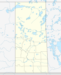
Location of Glenavon in Saskatchewan | |
| Coordinates: 50°10′52″N 103°07′55″W / 50.181°N 103.132°W | |
| Country | |
| Province | |
| Region | Saskatchewan |
| Census division | 5 |
| Rural Municipality | Chester No. 125 |
| Government | |
| • Type | Municipal |
| • Governing body | Glenavon Village Council |
| • Mayor | Eric Brown |
| • Administrator | Glen Glennerson |
| Area | |
• Total | 1.32 km2 (0.51 sq mi) |
| Population (2016) | |
• Total | 182 |
| • Density | 137.6/km2 (356/sq mi) |
| Time zone | UTC-6 (CST) |
| Postal code | S0G 1Y0 |
| Area code | 306 |
| Highways | |
| Railways | Canadian National Railway |
| [1][2][3][4] | |
Glenavon is a village within the Rural Municipality of Chester No. 125, in the province of Saskatchewan, Canada. The village had a population of 182 in the 2016 Canada Census, (a 3.4% increase from 176 in the 2011 Canada Census).
Demographics
Canada census – Glenavon, Saskatchewan community profile
| 2016 | 2011 | |
|---|---|---|
| Population | 182 (+3.4% from 2011) | 176 (-3.8% from 2006) |
| Land area | 1.32 km2 (0.51 sq mi) | 1.32 km2 (0.51 sq mi) |
| Population density | 137.6/km2 (356/sq mi) | 133.1/km2 (345/sq mi) |
| Median age | 54.0 (M: 51.5, F: 55.3) | 50.8 (M: 47.7, F: 55.0) |
| Private dwellings | 121 (total) | 118 (total) |
| Median household income |
See also
References
- ^ National Archives, Archivia Net, Post Offices and Postmasters, archived from the original on 2006-10-06
{{citation}}: Unknown parameter|deadurl=ignored (|url-status=suggested) (help) - ^ Government of Saskatchewan, MRD Home, Municipal Directory System, archived from the original on November 21, 2008
{{citation}}: Unknown parameter|deadurl=ignored (|url-status=suggested) (help) - ^ Canadian Textiles Institute. (2005), CTI Determine your provincial constituency, archived from the original on 2007-09-11
{{citation}}: Unknown parameter|deadurl=ignored (|url-status=suggested) (help) - ^ Commissioner of Canada Elections, Chief Electoral Officer of Canada (2005), Elections Canada On-line, archived from the original on 2007-04-21
{{citation}}: Unknown parameter|deadurl=ignored (|url-status=suggested) (help) - ^ "2016 Community Profiles". 2016 Canadian census. Statistics Canada. August 12, 2021. Retrieved 2017-03-15.
- ^ "2011 Community Profiles". 2011 Canadian census. Statistics Canada. March 21, 2019. Retrieved 2012-10-30.
- ^ "2006 Community Profiles". 2006 Canadian census. Statistics Canada. August 20, 2019.
- ^ "2001 Community Profiles". 2001 Canadian census. Statistics Canada. July 18, 2021.


