Nangal: Difference between revisions
No edit summary |
No edit summary |
||
| Line 50: | Line 50: | ||
| footnotes = http://nptinangal.in |
| footnotes = http://nptinangal.in |
||
}} |
}} |
||
'''Nangal''' is a town and municipal council in [[Rupnagar district]] in [[Punjab, India]]. It is 60 km from [[Rupnagar]] located on the |
'''Nangal''' is a town and municipal council in [[Rupnagar district]] in [[Punjab, India]]. It is 60 km from [[Rupnagar]] located on the national highway that connects [[Chandigarh]], [[Rupnagar]] and [[Kiratpur Sahib]] to [[Una, Himachal Pradesh|Una]], and further [[Kangra, Himachal Pradesh]], in the state of Punjab in northwest India. It sits at the foot of the [[Shiwalik Hills]] where it was established after plans for a dam required the movement of previously established villages. Residential areas include Shivalik Avenue, Naya Nangal Township, BBMB Township and downtown Nangal(Railway Road). |
||
==History== |
==History== |
||
Revision as of 09:17, 9 June 2018
Nangal
Industrial Town of Punjab | |
|---|---|
town | |
 | |
| Nickname: NPTI HPTC | |
| Coordinates: 31°23′06″N 76°22′30″E / 31.385°N 76.375°E | |
| Country | |
| State | Punjab |
| District | Rupnagar |
| Founded by | MOP Govt of India |
| Government | |
| • Type | MOP |
| Elevation | 326 m (1,070 ft) |
| Population (2011) | |
• Total | 48,497 |
| Languages | |
| • Official | Punjabi |
| Time zone | UTC+5:30 (IST) |
| PIN | 140124 |
| Vehicle registration | PB 74 |
| Website | http://rupnagar.nic.in/html/Nangal.htm |
| http://nptinangal.in | |
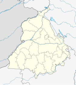
Nangal is a town and municipal council in Rupnagar district in Punjab, India. It is 60 km from Rupnagar located on the national highway that connects Chandigarh, Rupnagar and Kiratpur Sahib to Una, and further Kangra, Himachal Pradesh, in the state of Punjab in northwest India. It sits at the foot of the Shiwalik Hills where it was established after plans for a dam required the movement of previously established villages. Residential areas include Shivalik Avenue, Naya Nangal Township, BBMB Township and downtown Nangal(Railway Road).
History
Present Nangal is situated on the land acquired from nearby places in 1948 when the construction of Bhakra Dam was planned on the Satluj River. The town is divided into three parts: Nangal, Nangal Township and Naya Nangal.
Geography
Nangal is situated on the foot of Shivalik hills and spreads over both sides of river Sutlej which forms a lake behind the Nangal Dam. Every year, the multi-purpose Bhakra Dam with its surrounding natural environment attracts a number of tourists from all parts of India and abroad.[citation needed] There are several markets in it, namely Jawahar Market, Main Market, Adda Market, GTB Market & Pahari Market. The residential areas of the city are organized into a block system.
Nangal Township is surrounded by water on three sides and foothills of shivaliks on the fourth side. Naya Nangal serves mainly as a fertilizer complex of National Fertilizers Limited (NFL), a public sector undertaking of the Government of India.
Demographics
As of 2011[update] India Census,[1] Nangal had a population of 48,497. Males constitute 53% of the population and females 47%. Nangal has an average literacy rate of 82%, higher than the national average of 74%: male literacy is 85%, and female literacy is 79%. In Nangal, 9% of the population is under 6 years of age.
References
- ^ "Census of India 2001: Data from the 2001 Census, including cities, villages and towns (Provisional)". Census Commission of India. Archived from the original on 16 June 2004. Retrieved 1 November 2008.


