Chokwe, Mozambique: Difference between revisions
No edit summary Tags: Mobile edit Mobile web edit |
No edit summary |
||
| Line 115: | Line 115: | ||
! Population<ref name=wg>{{cite web |url=http://world-gazetteer.com/wg.php?x=&men=gcis&lng=en&des=wg&srt=npan&col=abcdefghinoq&msz=1500&geo=-153 |title=Mozambique: largest cities and towns and statistics of their population |accessdate=2008-06-18 |work=World Gazetteer |date= |deadurl=yes |archiveurl=https://web.archive.org/web/20081231073437/http://world-gazetteer.com/wg.php?x=&men=gcis&lng=en&des=wg&srt=npan&col=abcdefghinoq&msz=1500&geo=-153 |archivedate=2008-12-31 |df= }}</ref> |
! Population<ref name=wg>{{cite web |url=http://world-gazetteer.com/wg.php?x=&men=gcis&lng=en&des=wg&srt=npan&col=abcdefghinoq&msz=1500&geo=-153 |title=Mozambique: largest cities and towns and statistics of their population |accessdate=2008-06-18 |work=World Gazetteer |date= |deadurl=yes |archiveurl=https://web.archive.org/web/20081231073437/http://world-gazetteer.com/wg.php?x=&men=gcis&lng=en&des=wg&srt=npan&col=abcdefghinoq&msz=1500&geo=-153 |archivedate=2008-12-31 |df= }}</ref> |
||
|- |
|- |
||
| 1997 |
| 1997 census |
||
| |
| 49,730 |
||
|- |
|- |
||
| 2007 census |
|||
| 2008 |
|||
| |
| 53,062 |
||
|} |
|} |
||
Revision as of 05:35, 22 June 2018
Chokwe | |
|---|---|
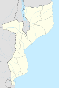
| Coordinates: 24°31′31″S 33°0′31″E / 24.52528°S 33.00861°E | |
| Country | |
| Provinces | Gaza Province |
| Population (2007 census) | |
• Total | 53,062 |
Chokwé, and earlier known as Vila Trigo de Morais, is a rural town and capital of Chokwe District in the province of Gaza in Mozambique. It is located about 230 km north of the capital city of Maputo. This agricultural town is noted for its tomatoes.[1]
Economy
Chokwe lies in the mixed farming zone on the southern side of the Limpopo river. There has been recent immigration of cattle and people into this relatively safe town and district from surrounding areas affected by the war, and concentration of a previously more scattered population into villages on the edge of a large irrigation scheme. This has caused many cattle to die of hunger in the dry season.[2]
Floods of 2010 and 2013
Despite the relative safety, in 2000 the town and its surroundings were particularly hard hit by rising flood waters from the Limpopo River.
In 2013, the city "was devastated by the flooding of the Limpopo River. Most of its 70,000 residents escaped with whatever they could grab." Many evacuated to the Chiaquelane accommodation center.[3][4][5]
Demographics
| Year | Population[6] |
|---|---|
| 1997 census | 49,730 |
| 2007 census | 53,062 |
Transport
Chokwe is served by a station on the southern line of Mozambique Railways.
See also
References
- ^ http://allafrica.com/stories/200008080305.html
- ^ Timberlake, J., Livestock production systems in Chokwe, southern Mozambique, UNDP/FAO, Land and Water Department, National Agronomic Research Institute (INIA) in Maputo
- ^ "Stewart Sukuma, UNICEF Goodwill Ambassador, visits flood victims in Mozambique". UNICEF Mozambique - Voices. 2013-01-27. Retrieved 2014-06-08.
- ^ "Fleeing the Floods in Mozambique". UNICEF USA Blog. Retrieved 2014-06-08.
- ^ "Visiting Chiaquelane's Medical Tent - Mozambique". ReliefWeb. 2013-01-31. Retrieved 2014-06-08.
- ^ "Mozambique: largest cities and towns and statistics of their population". World Gazetteer. Archived from the original on 2008-12-31. Retrieved 2008-06-18.
{{cite web}}: Unknown parameter|deadurl=ignored (|url-status=suggested) (help)

