Gorjuša: Difference between revisions
Appearance
Content deleted Content added
JJMC89 bot (talk | contribs) Migrate {{Infobox settlement}} coordinates parameters to {{Coord}}, see Wikipedia:Coordinates in infoboxes |
→External links: commonscat |
||
| Line 116: | Line 116: | ||
== External links == |
== External links == |
||
*{{commons category-inline|Gorjuša}} |
|||
*[http://www.geopedia.si/Geopedia_en.html#L5567_F10090814_vF_b4_x471829.5_y110227.5_s14 Gorjuša on Geopedia] |
*[http://www.geopedia.si/Geopedia_en.html#L5567_F10090814_vF_b4_x471829.5_y110227.5_s14 Gorjuša on Geopedia] |
||
Revision as of 15:38, 18 August 2018
Gorjuša | |
|---|---|
 | |
| Coordinates: 46°8′19.67″N 14°38′11.13″E / 46.1387972°N 14.6364250°E | |
| Country | |
| Traditional region | Upper Carniola |
| Statistical region | Central Slovenia |
| Municipality | Domžale |
| Area | |
• Total | 2.99 km2 (1.15 sq mi) |
| Elevation | 335.2 m (1,099.7 ft) |
| Population (2002) | |
• Total | 128 |
| [1] | |
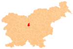
Gorjuša (pronounced [ɡɔˈɾjuːʃa]) is a small village in the Municipality of Domžale in the Upper Carniola region of Slovenia.[2]
Krumperk Castle stands just south of the settlement.
References
External links
 Media related to Gorjuša at Wikimedia Commons
- Gorjuša on Geopedia


